I grew up living in a city but being drawn to wilderness. Being in Ontario has allowed me to experience rugged, untouched wilderness in relative isolation (there is so much water everywhere and the province covers a vast territory, much of which is inaccessible by road; in addition, populated areas are relatively concentrated). I’ve travelled, canoed and hiked in many beautiful, wilderness areas exploring the varied landscape and geology and studying the behaviour of water.
One part of Ontario that I’ve have made repeated excursions to is the Niagara Peninsula. On a recent trip to the area, I visited the Niagara River which runs through the Niagara Gorge (over 400 million years old!).
I want to share a little about this place. I’ll first provide just a little background about the area and then tell you about my experiences on this trip and show some paint sketches I made and photographs I took.
The Niagara Escarpment is one section of an escarpment that begins and ends in the United States (from near Watertown, NY, west across Ontario and south to just north of Chicago) and is known by different names dependent on geography (Niagara Peninsula, Bruce Peninsula, Upper Peninsula, Door Peninsula, Bayshore Blufflands). It defines some of the shorelines of lakes Ontario, Huron and Michigan. The Ontario portion of the escarpment is host to the Bruce Trail (http://brucetrail.org) which traverses Ontario from Queenston to Tobermory.
The escarpment is essentially one long cliff-face that was once under water. It is comprised of hard sedimentary limestone over softer shale and is the result of erosion (the shale, being the softer of the two, erodes away faster, thus forming the cliff-face/escarpment).
The Niagara Escarpment is a UNESCO World Biosphere Reserve.
The Niagara Peninsula is the area of land in Ontario between Lakes Erie and Ontario; the Niagara Escarpment runs through it.
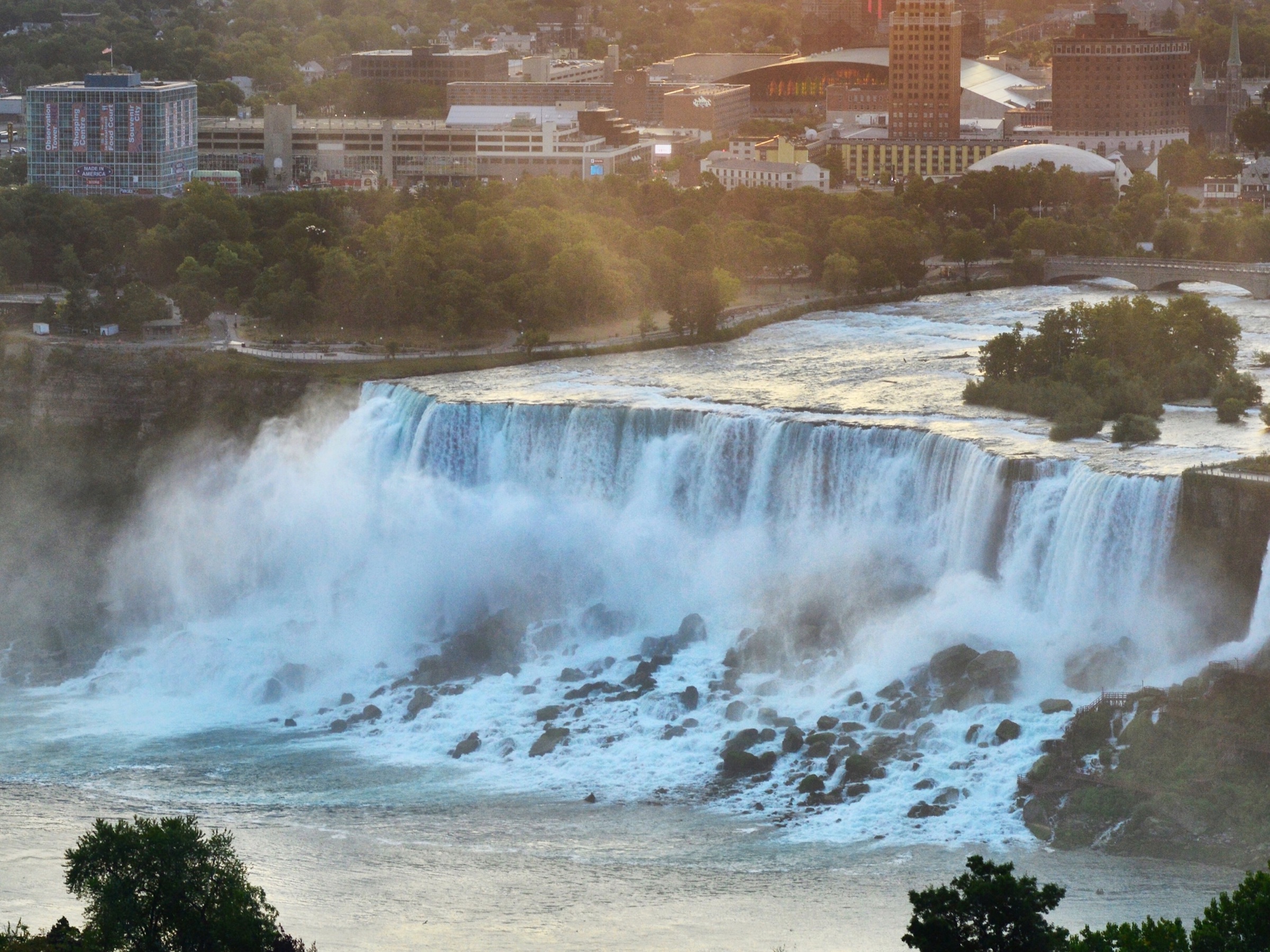
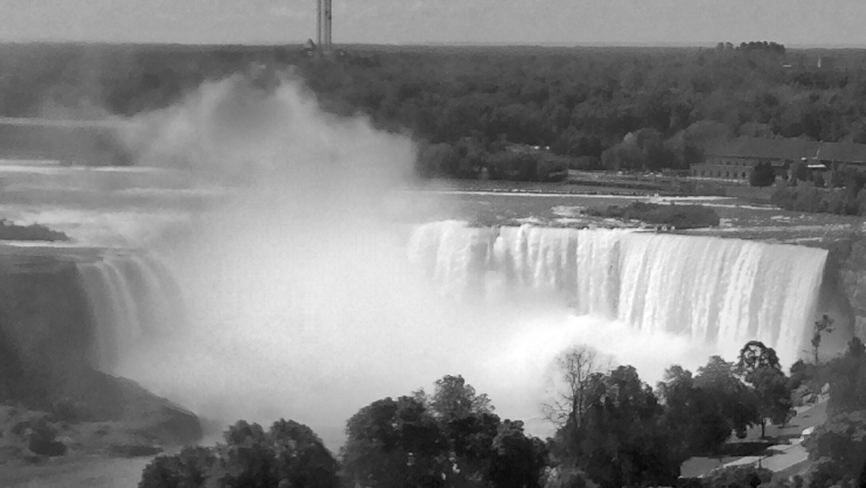
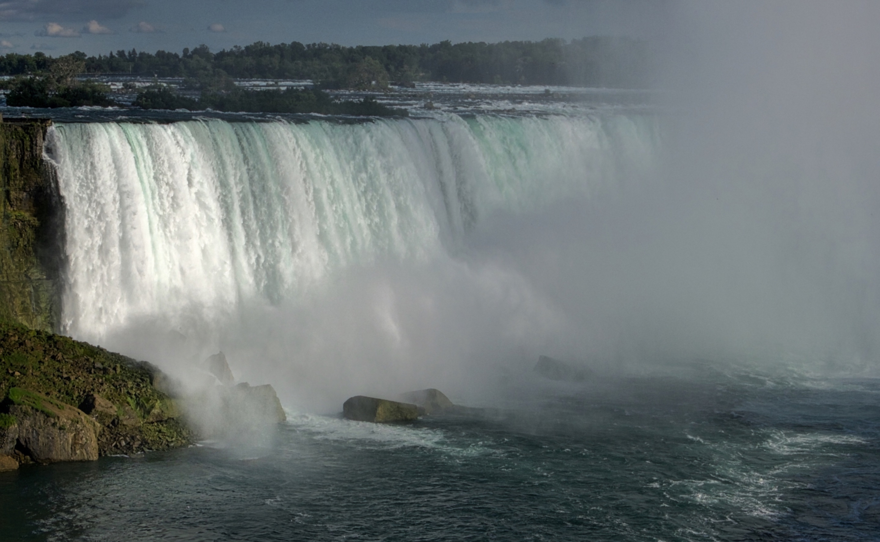
The most famous feature of this area is Niagara Falls (comprised of the American and Horseshoe falls).
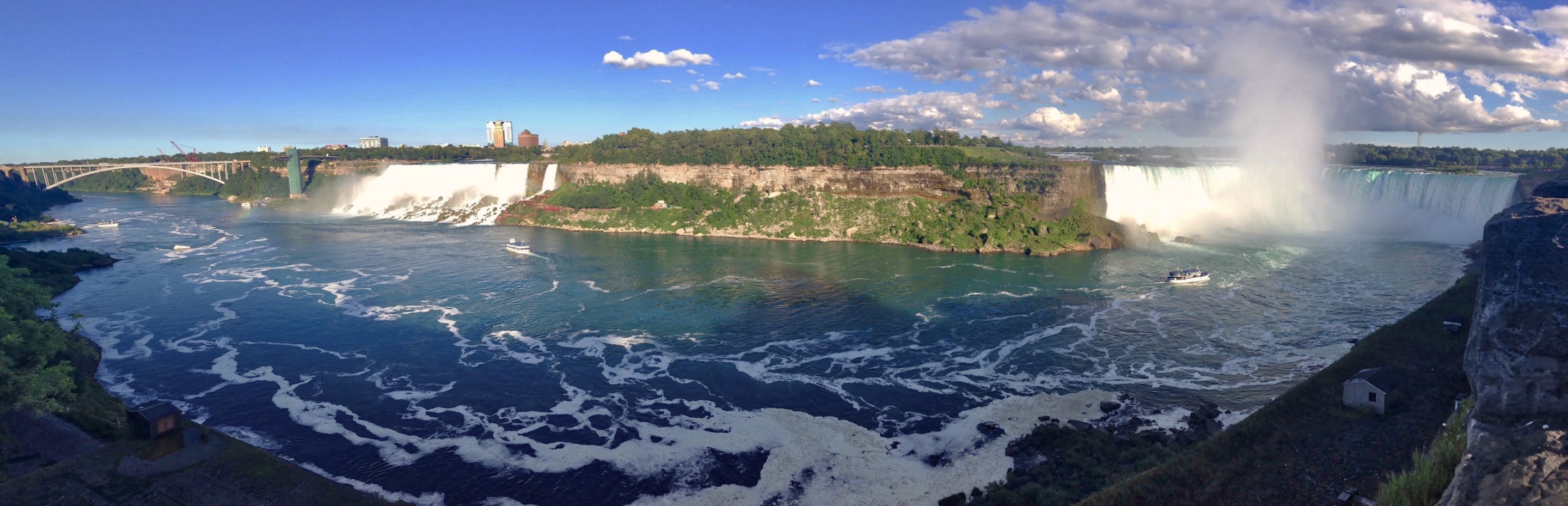
American Falls:
Horseshoe Falls:
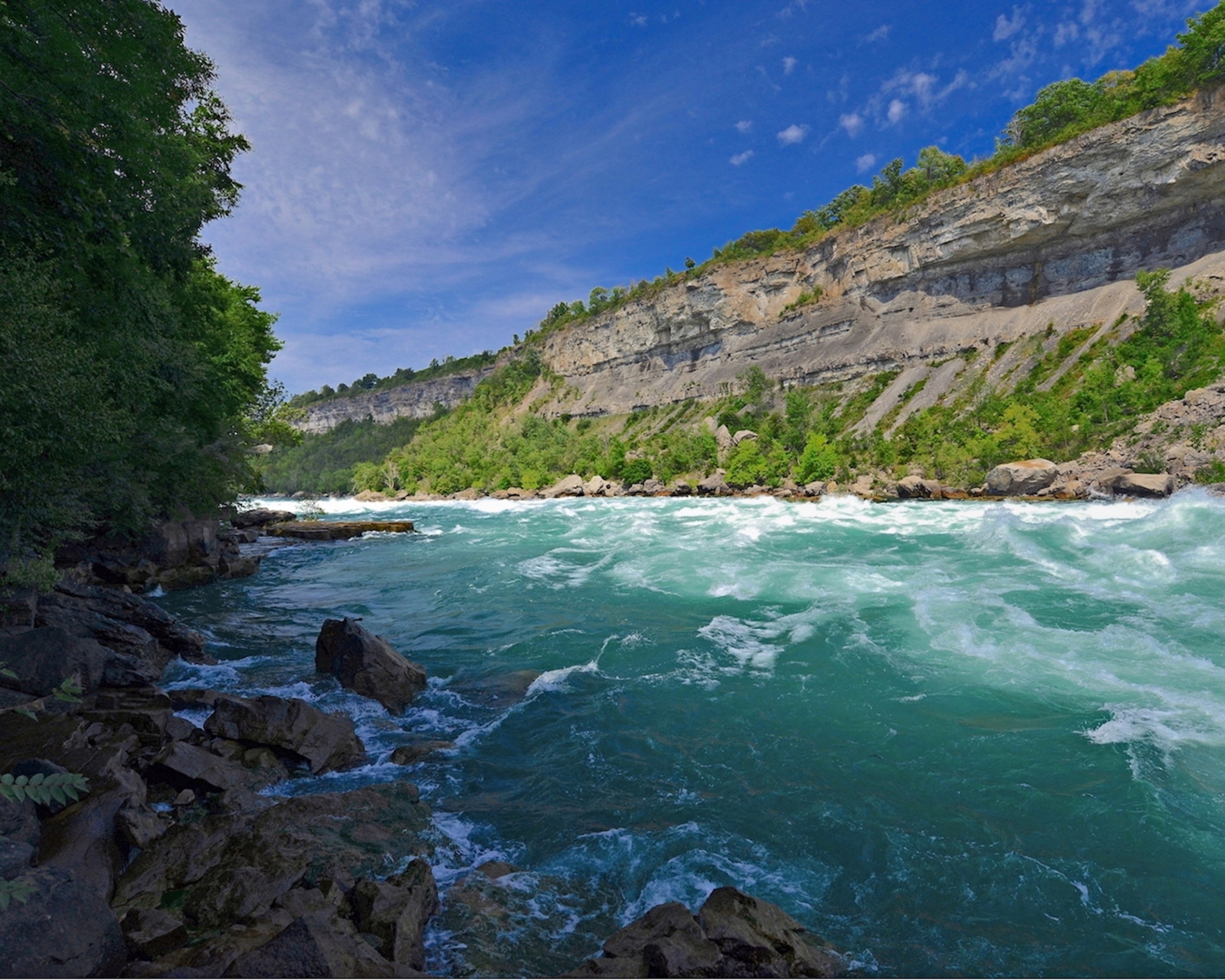
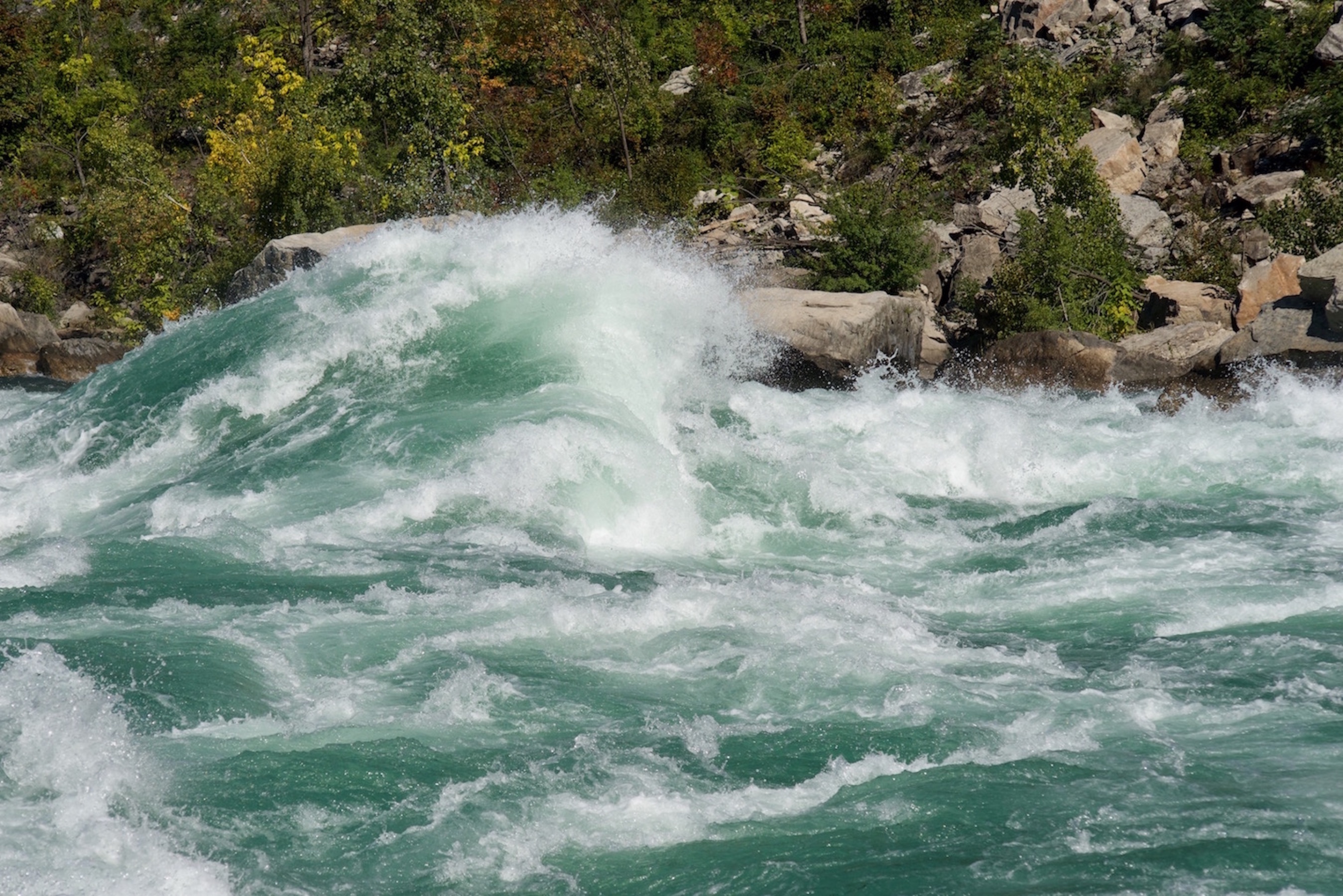
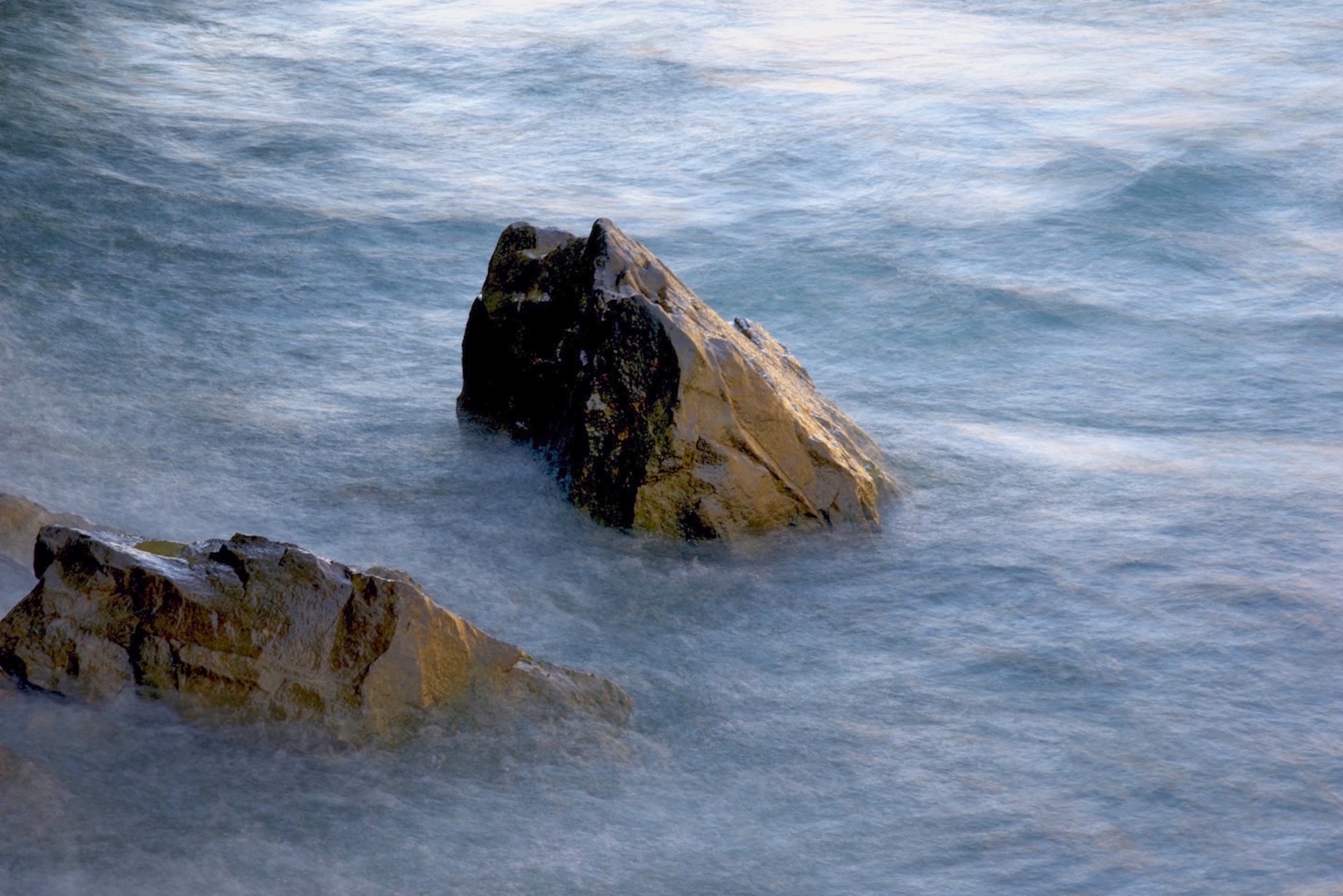
The area I visited on this past trip was downstream of the falls where the Niagara River travels through many gorges towards its destination of Lake Ontario. There are many landscape painting and photography opportunities along this river…one of my favourite locations for inspiration.
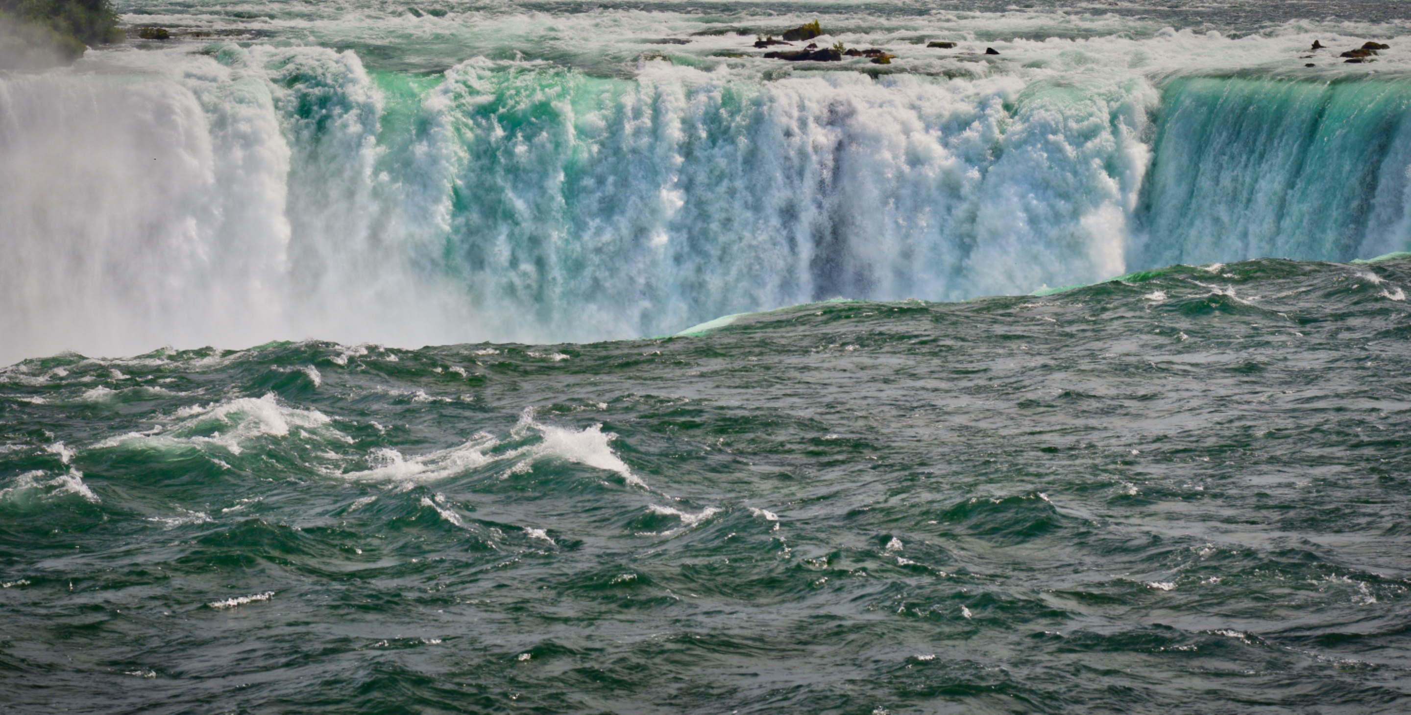
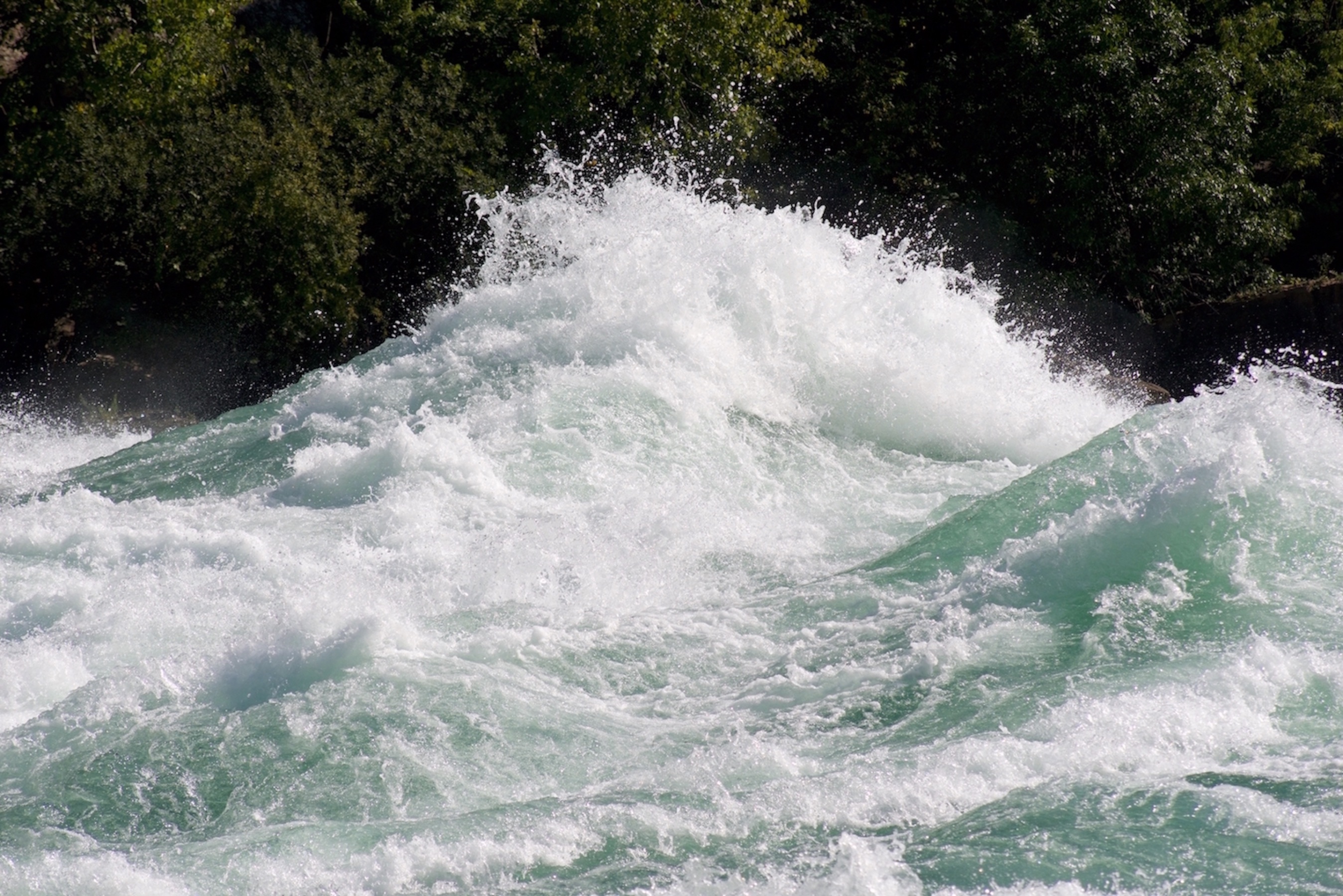
The water in this part of the Niagara River travels at a speed of 48 kilometres (30 miles) per hour, and the rapids are rated as class 6 (highest rating). This is one of the world’s wildest stretches of whitewater. The rapids run for 4 kilometres with 3-5 meter standing waves, making this the largest series of standing waves in North America.
It’s an amazing site to behold…there is so much power in the water.
This is what I find fascinating about this particular section of the river…
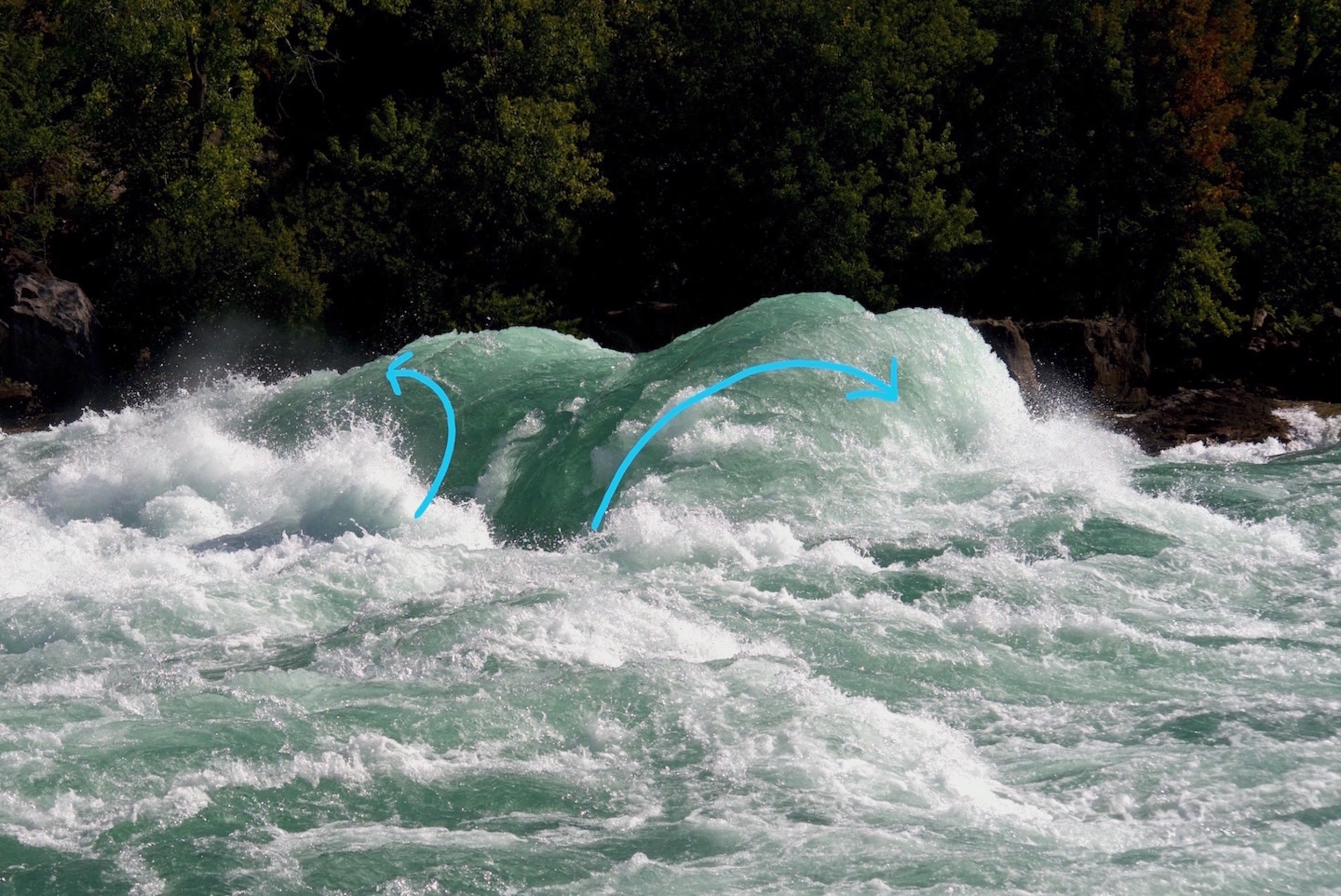
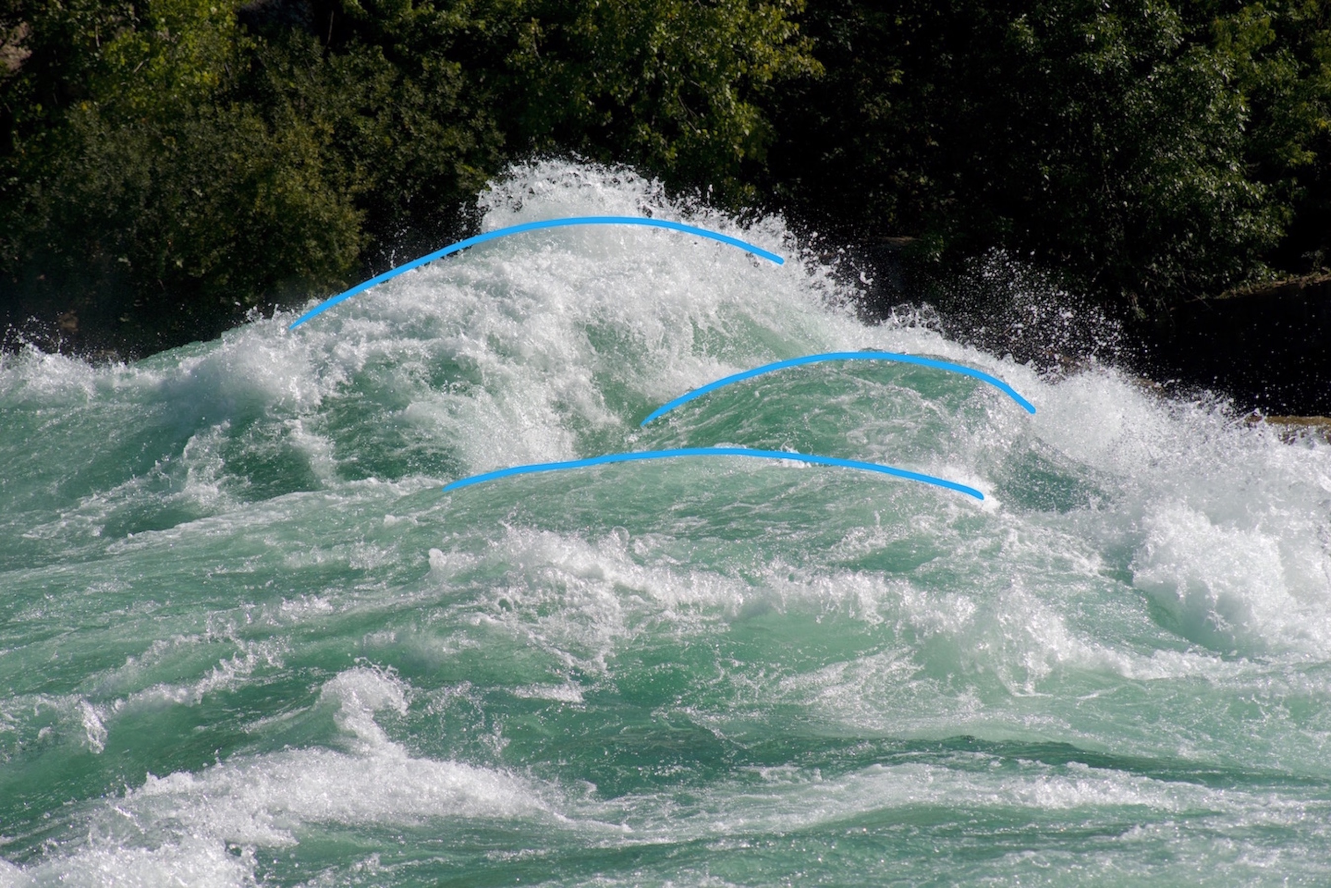
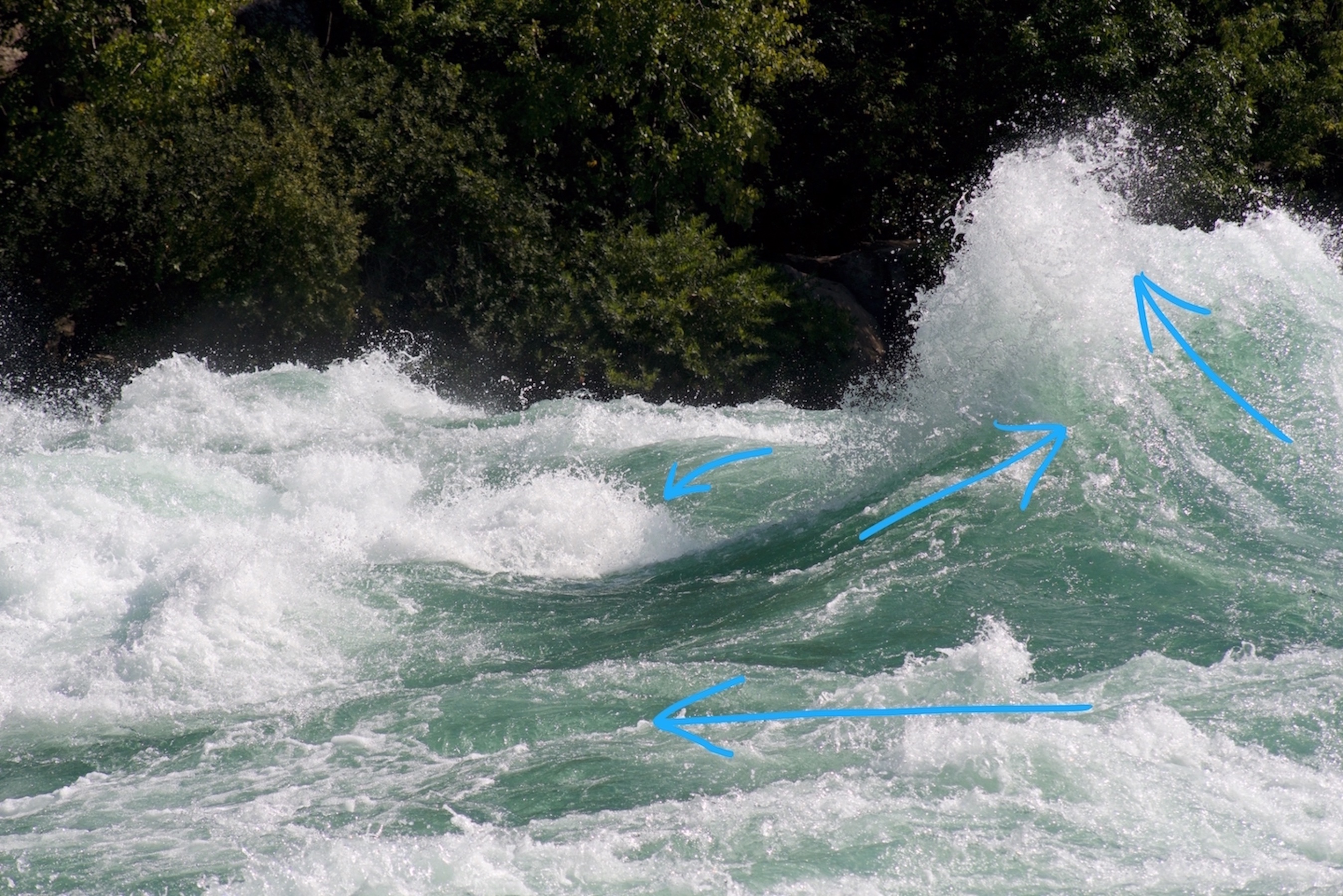
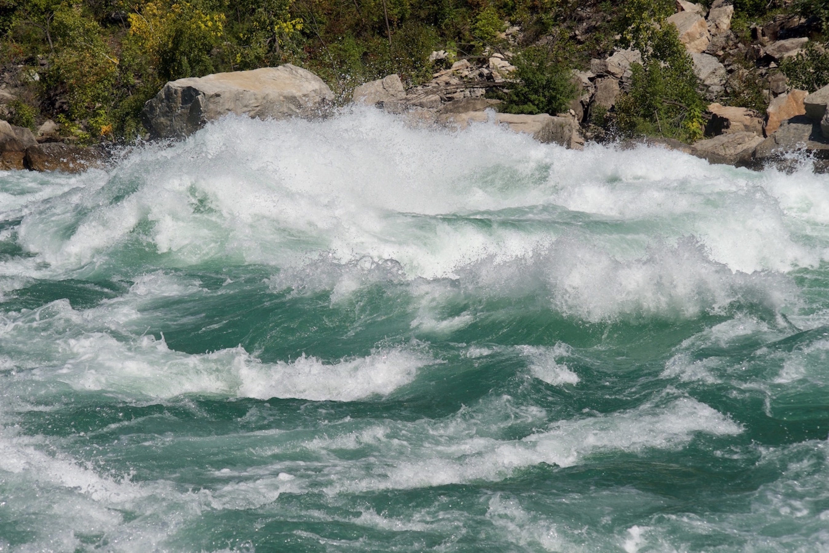
What is unique about the wave formations is that they are created by the sheer force of the water (15-38 meters deep and 70 meters across) being channelled through a narrow gorge and not by rock formations under the surface. This makes these rapids untraversable as there is no predictable behaviour to use to navigate the river (as in whitewater rafting where underwater rock structures channel water flow around them in a consistent and realtively predictable manner). Swells randomly interact with each other and their course cannot be predetermined…and when they collide…
Here are two swells that happened to bump into each other as they were breaking the river’s surface…like boiling water. It’s quite exciting to witness this first-hand. The swells are large, and they rise quite quickly before breaking up.
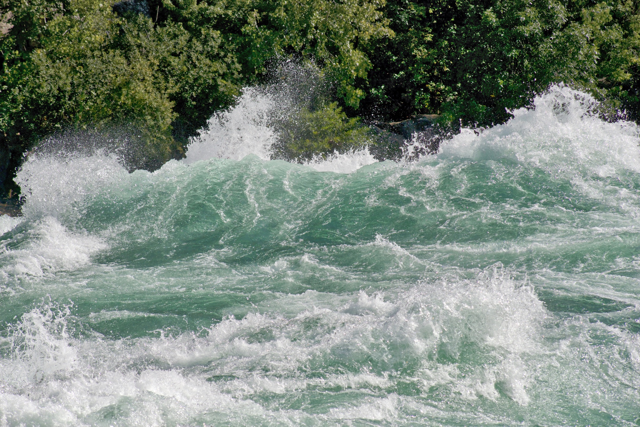
It’s hard to describe the mass of water and convey the speed at which it’s moving. What is seen is only the surface of the river, so it’s difficult to conceive of the amount of water that’s actually in front of you.
It’s extremely turbulent, and there is a constant loud roar.
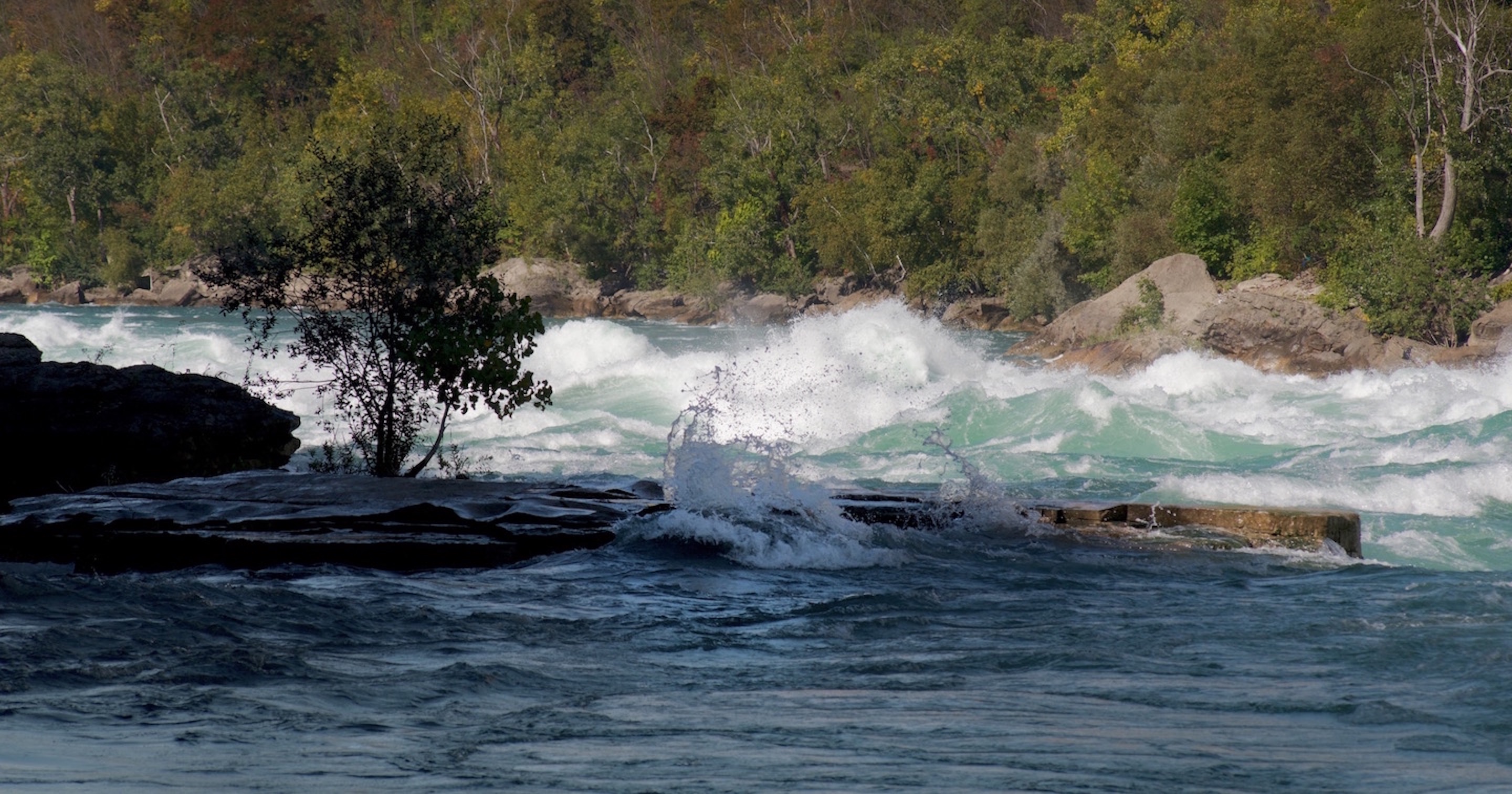
Here is a photo of a travelling wall of water that was blocking my view of the opposite bank of the river for a moment (as it rushed by—travelling towards the left):
Here are some photos from across the river close to the opposite shore.
The first is of a swell breaking the surface (as it rose up above it in the opposite direction to the current) followed by a shot of displaced water when the swell crashed back into the river (river was travelling right to left at 48 km/hr).
Can you imagine the noise of the splash? You could almost feel it.
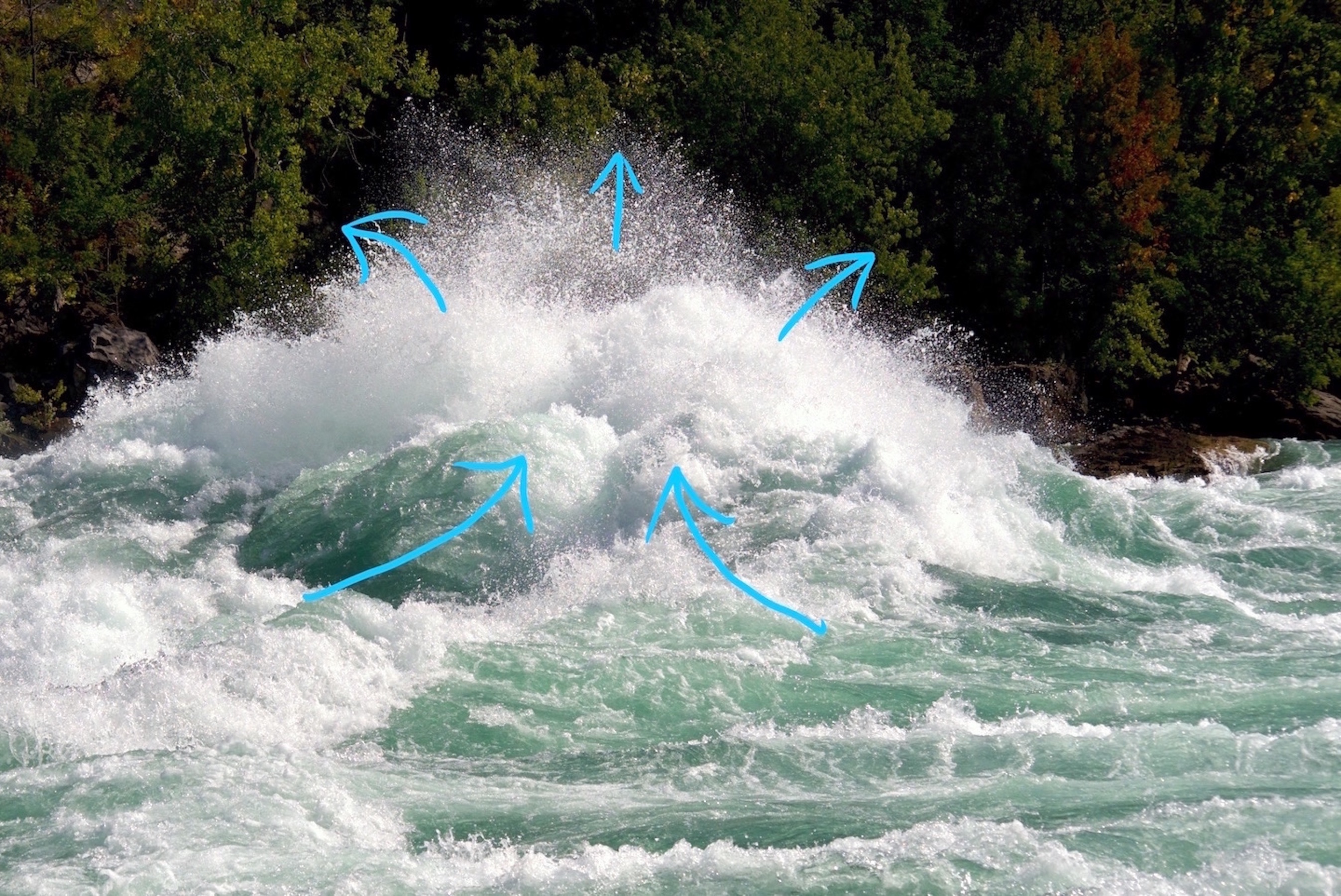
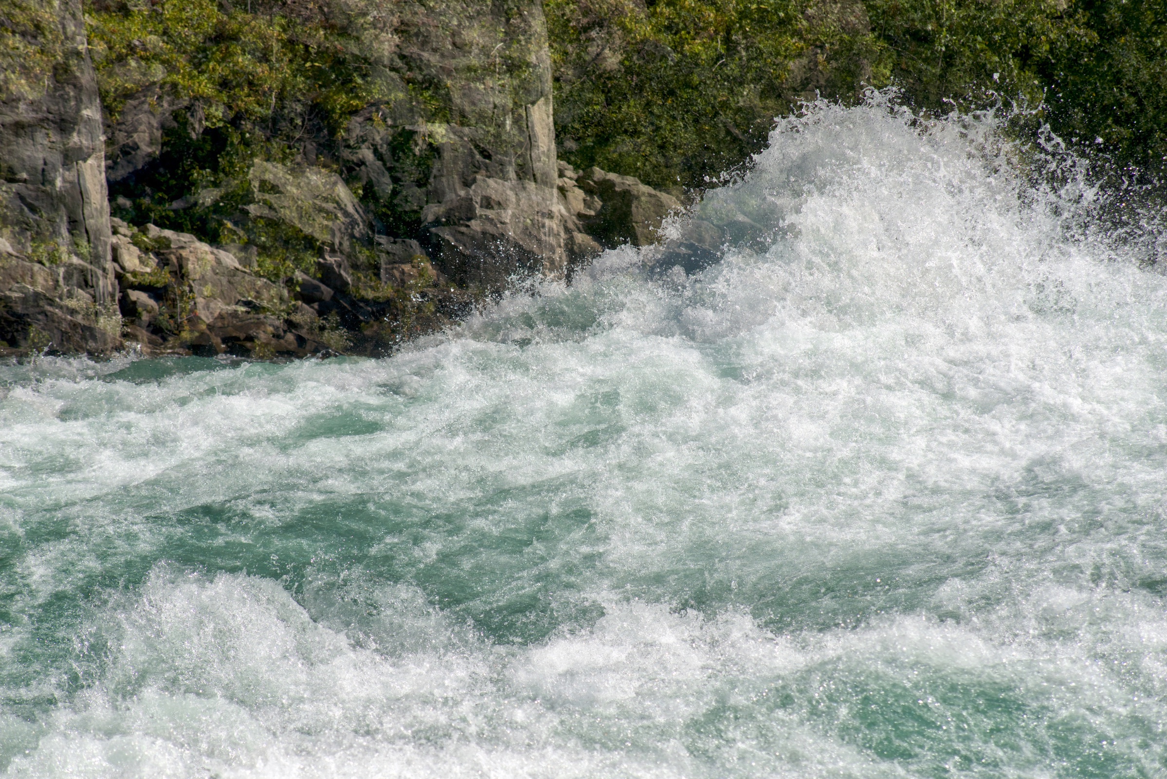
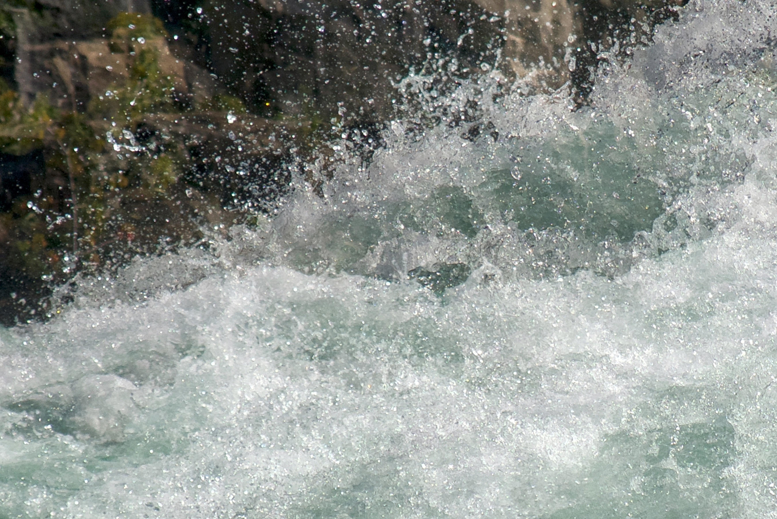
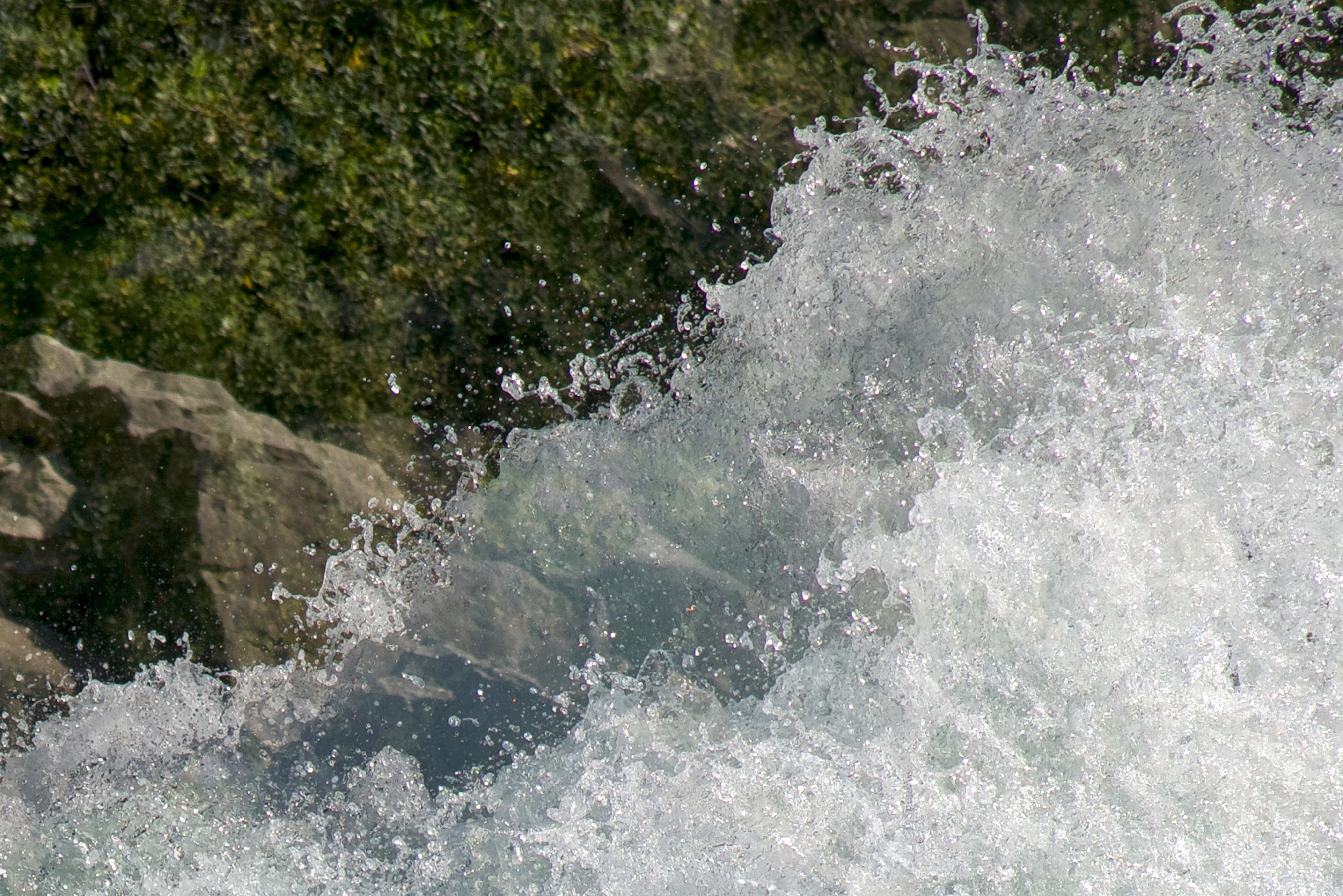
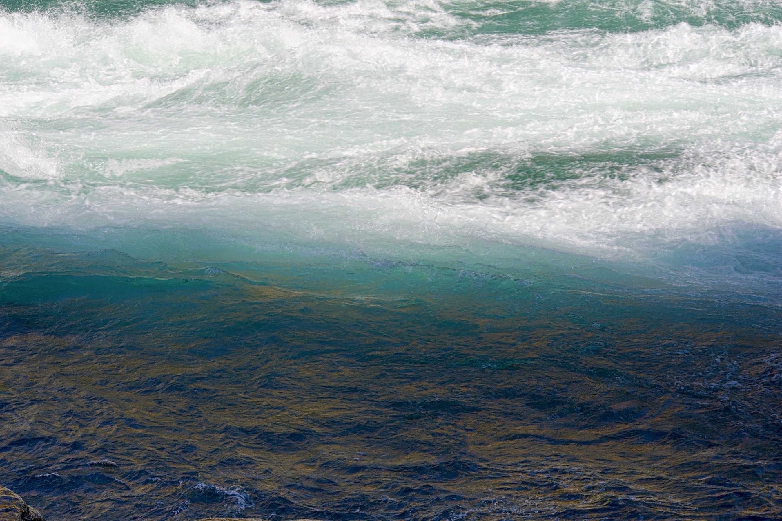
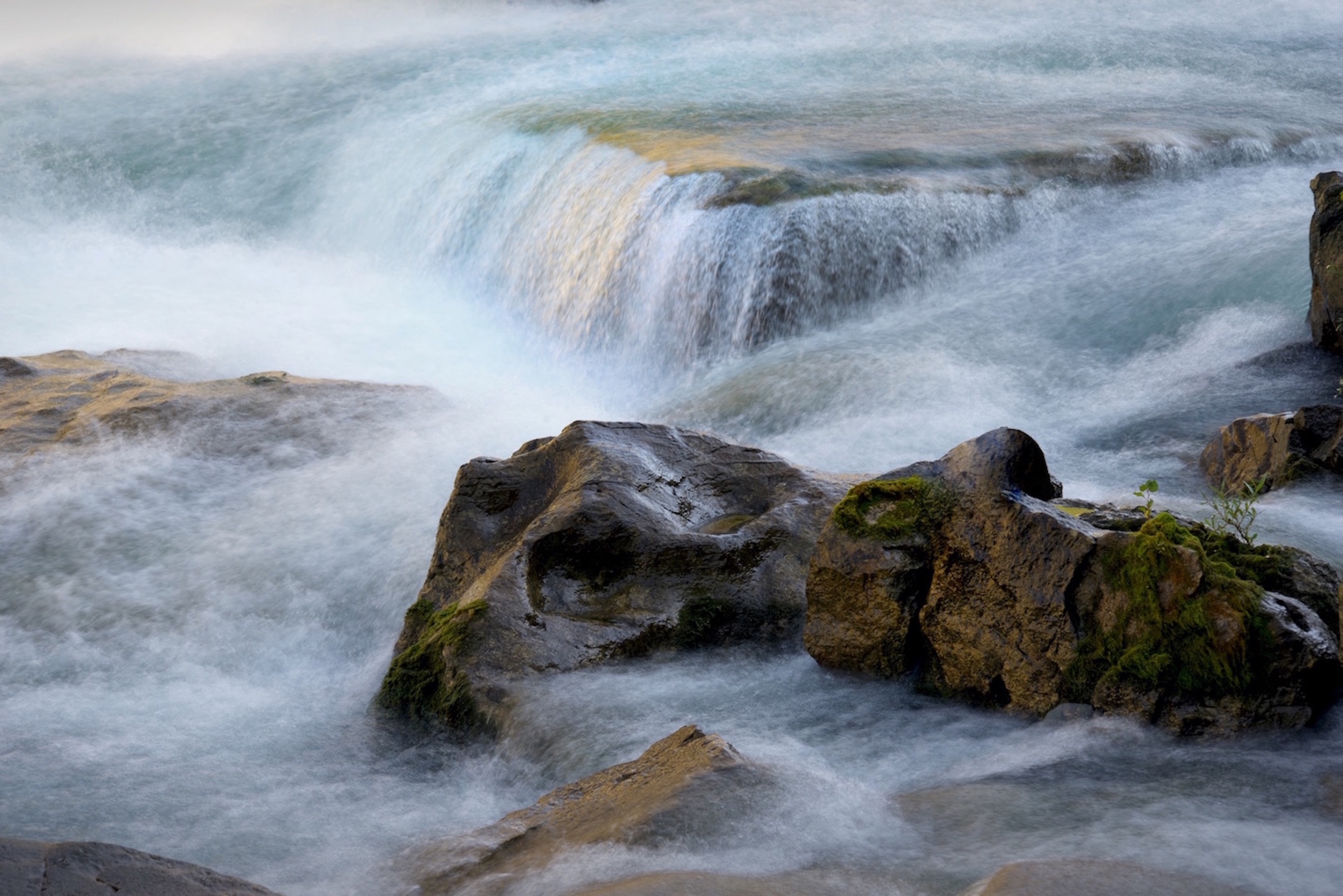
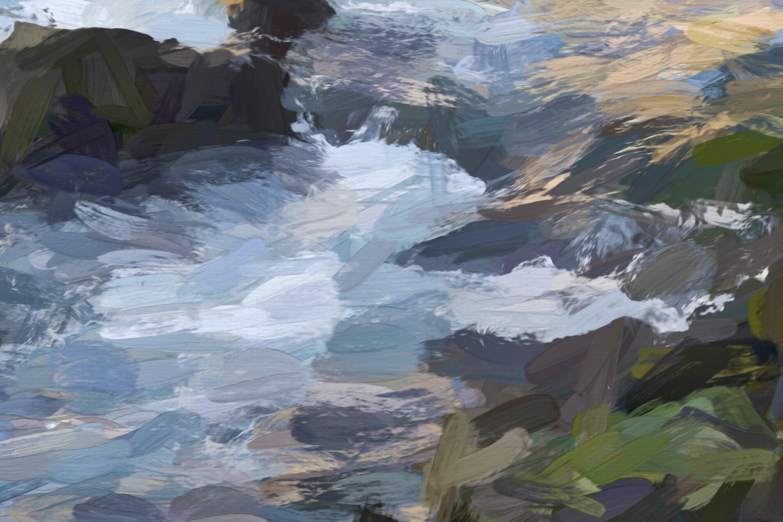
Here are some photos where I wanted to capture a sense of the amount of whitewater.
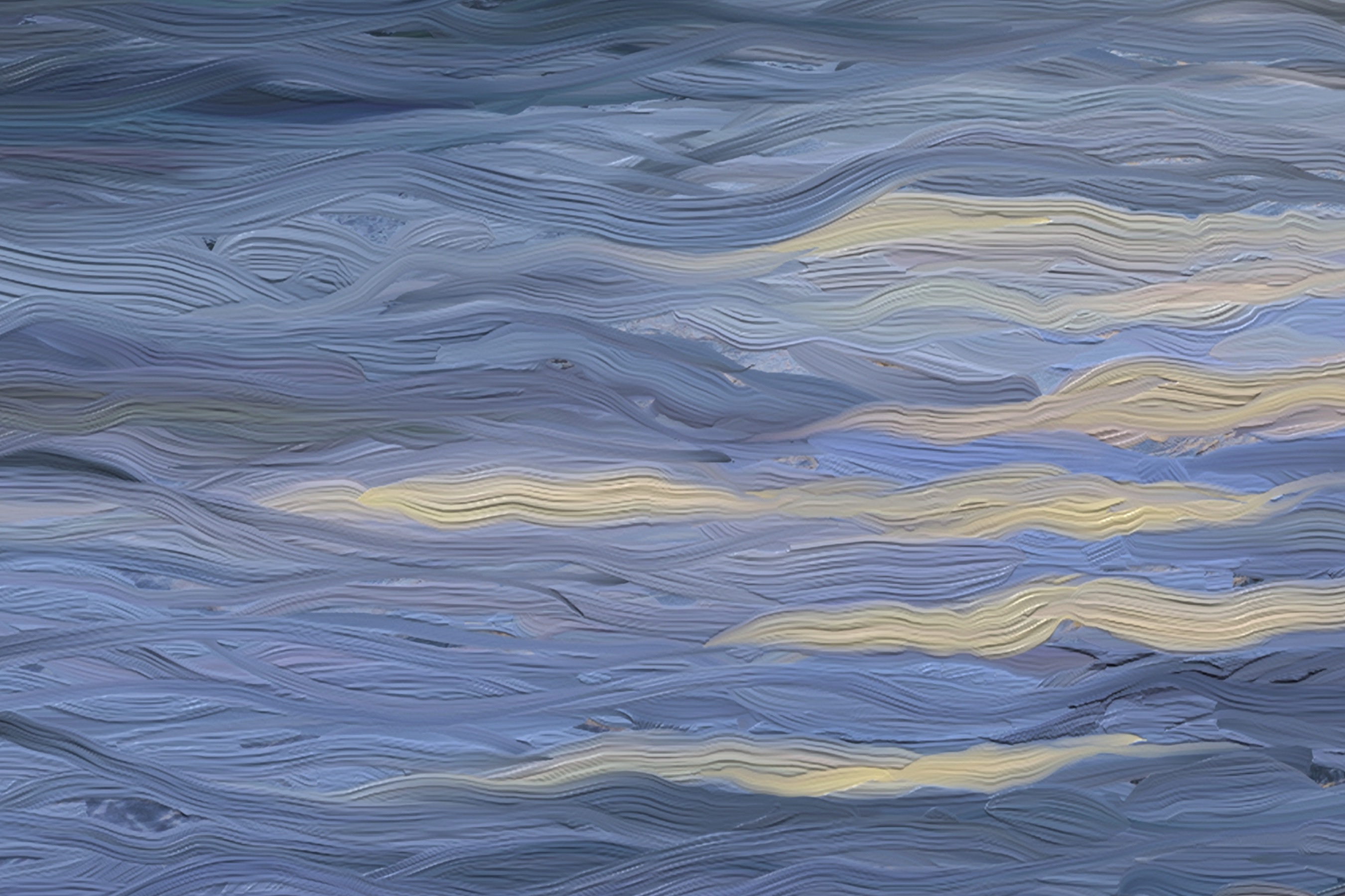
This is difficult to accomplish with an individual photo, so I made these photographs by overlaying several exposures to capture multiple instances of breaking waves in each final image. This results in a certain amount of transparency in some of the wave formations and also more of a sense of the water’s movement. It is precisely this sense of translucency and motion that I strive to capture in many of my paintings. I’ve provided close-ups of the areas of translucency following each photograph.
Photo 1:
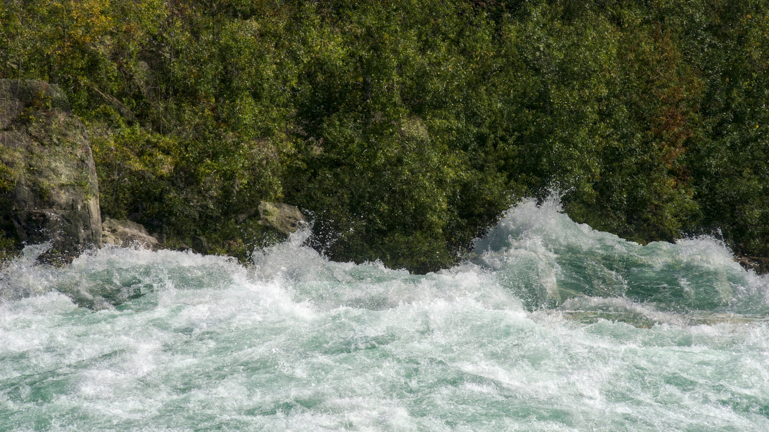
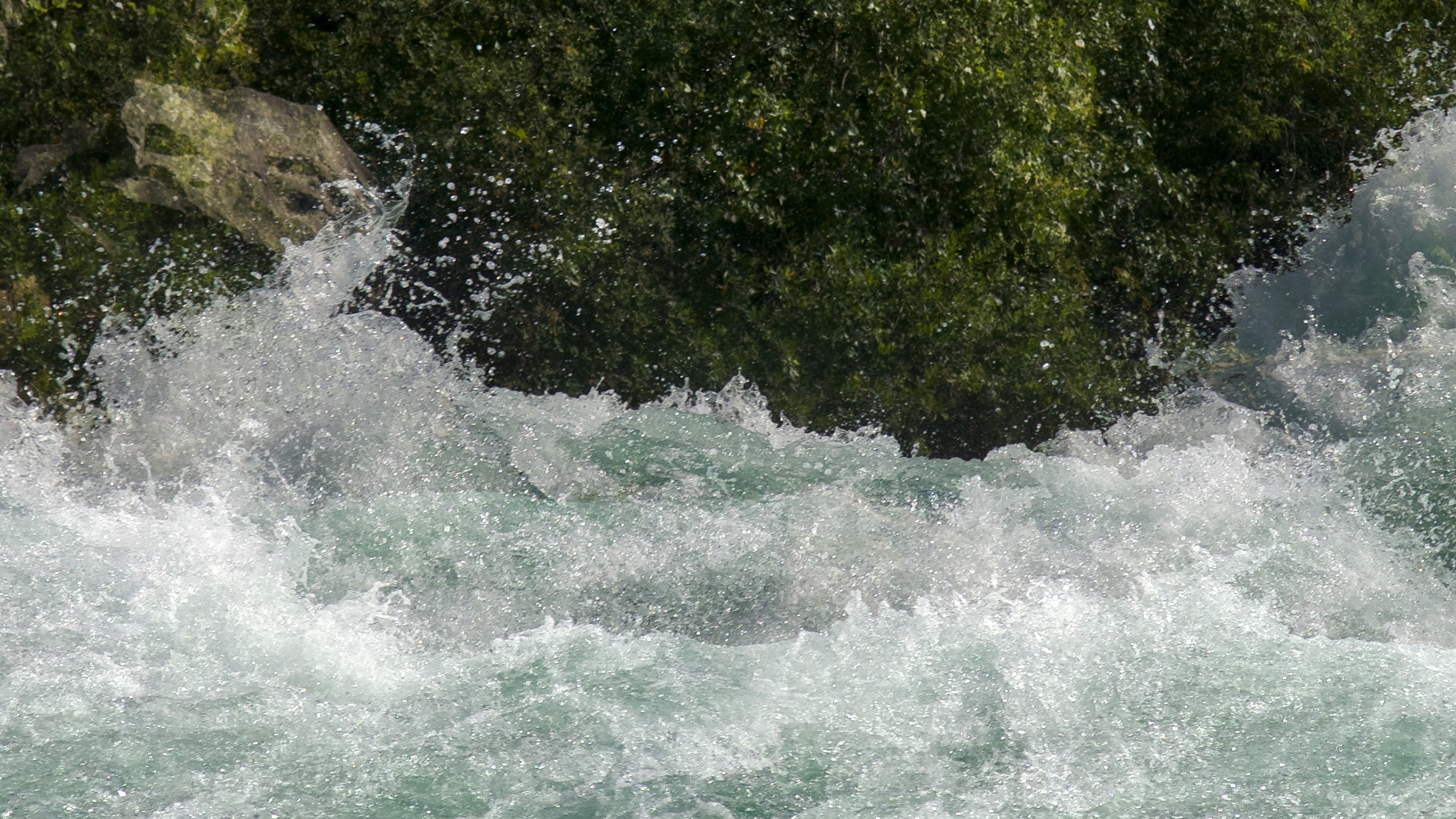
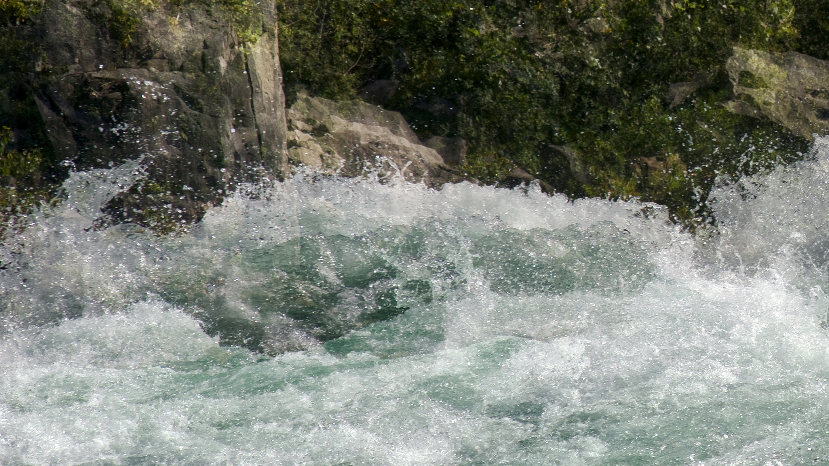
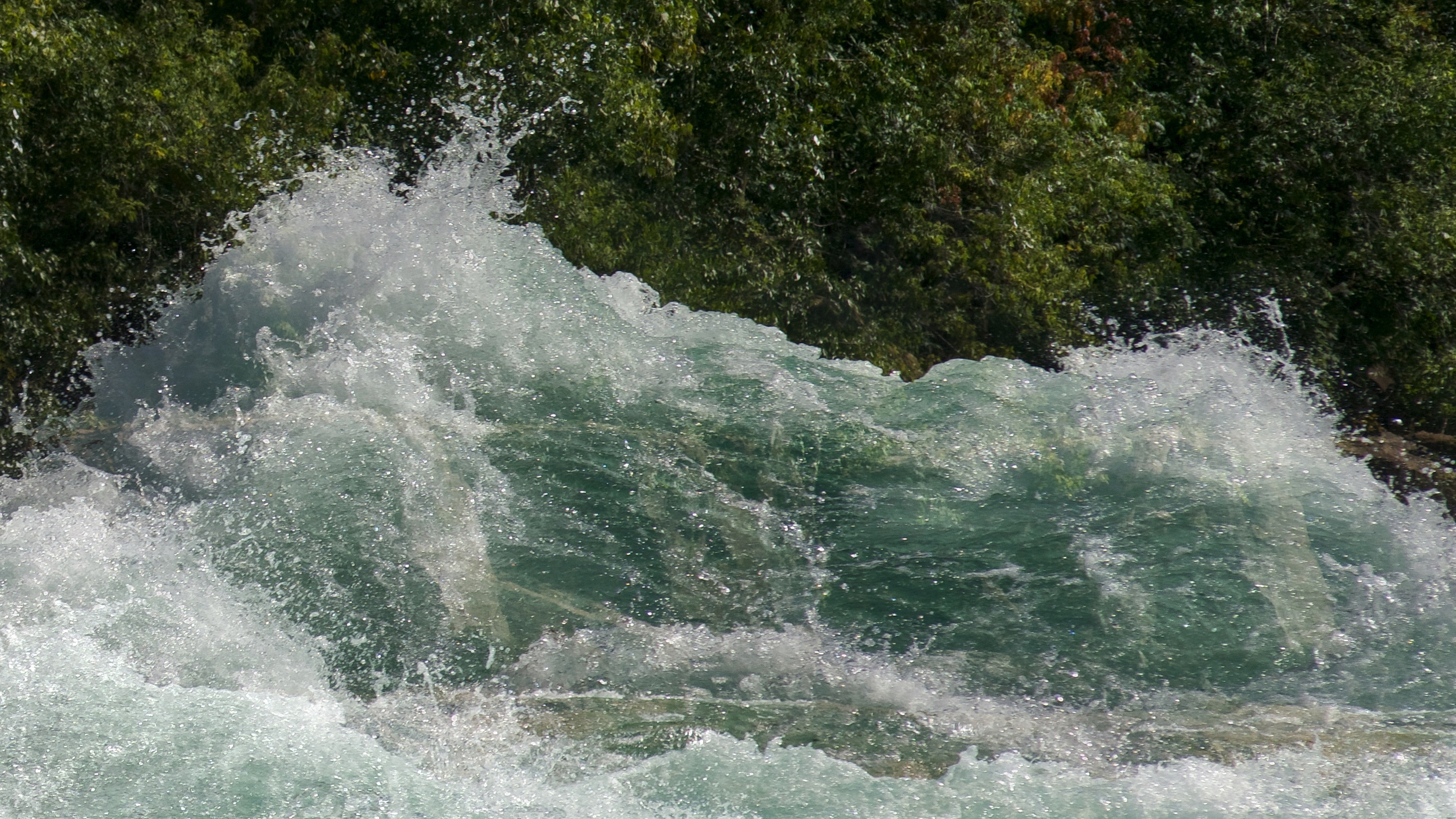
Photo 2:
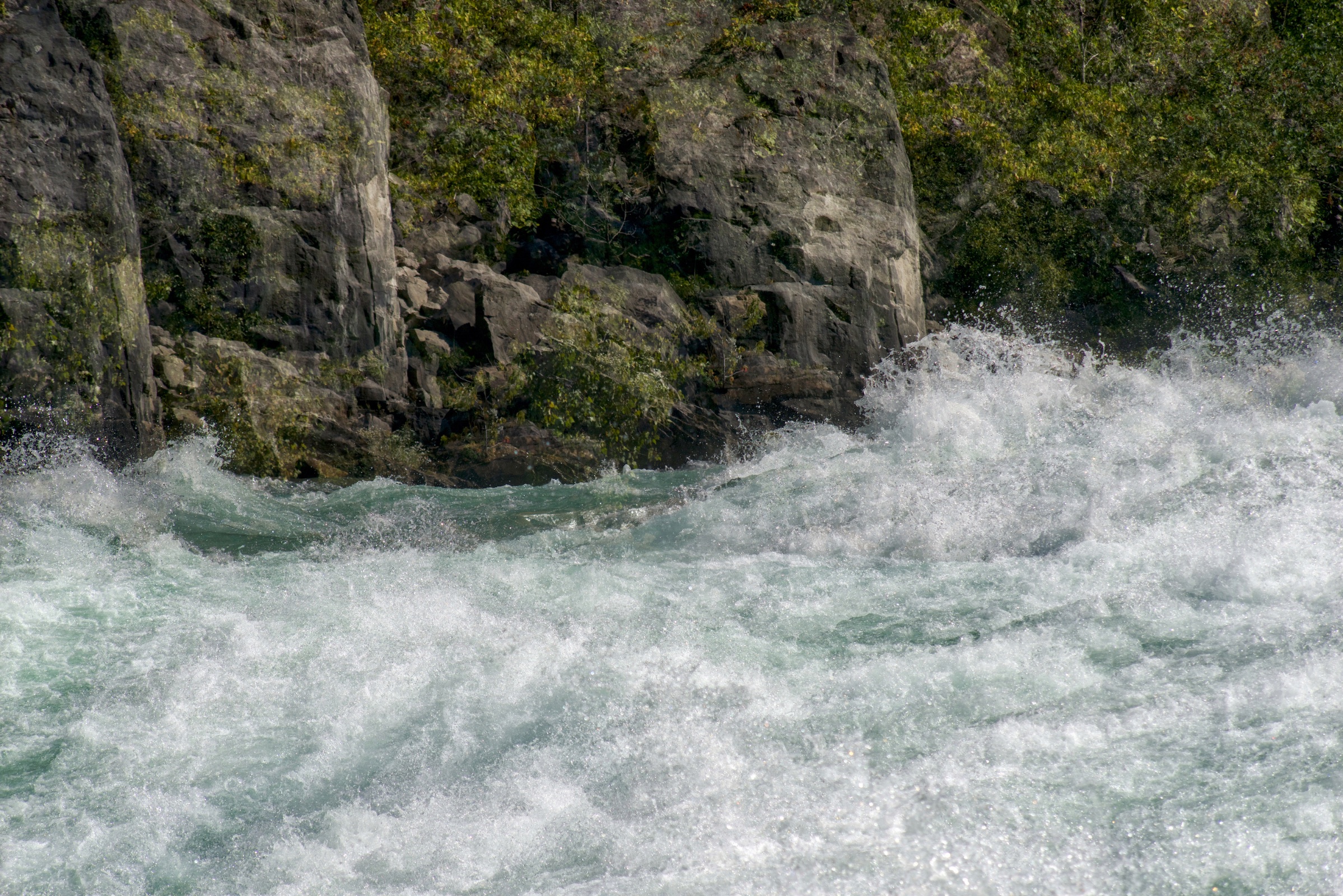
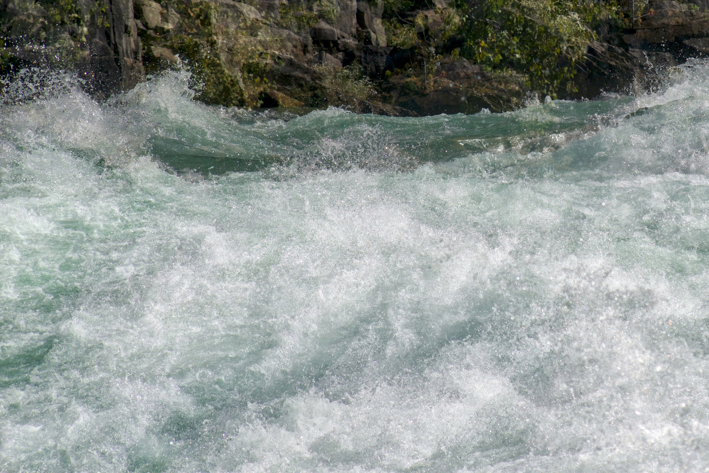
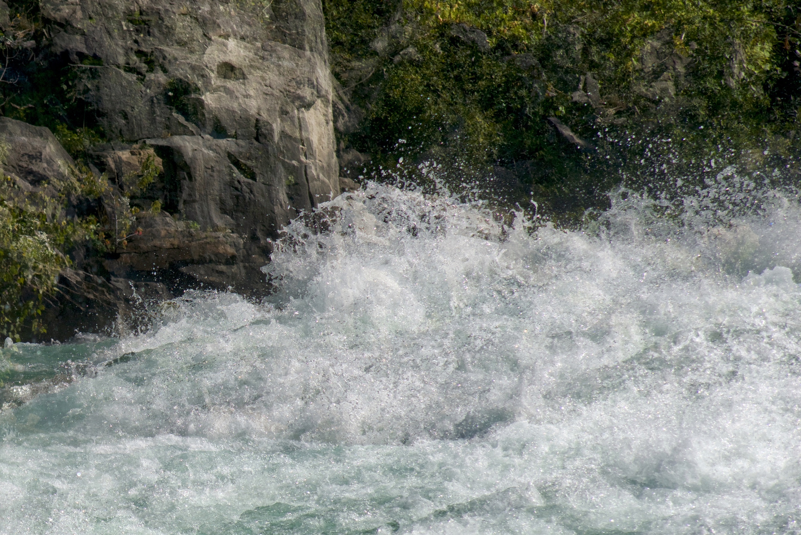
Photo 3:
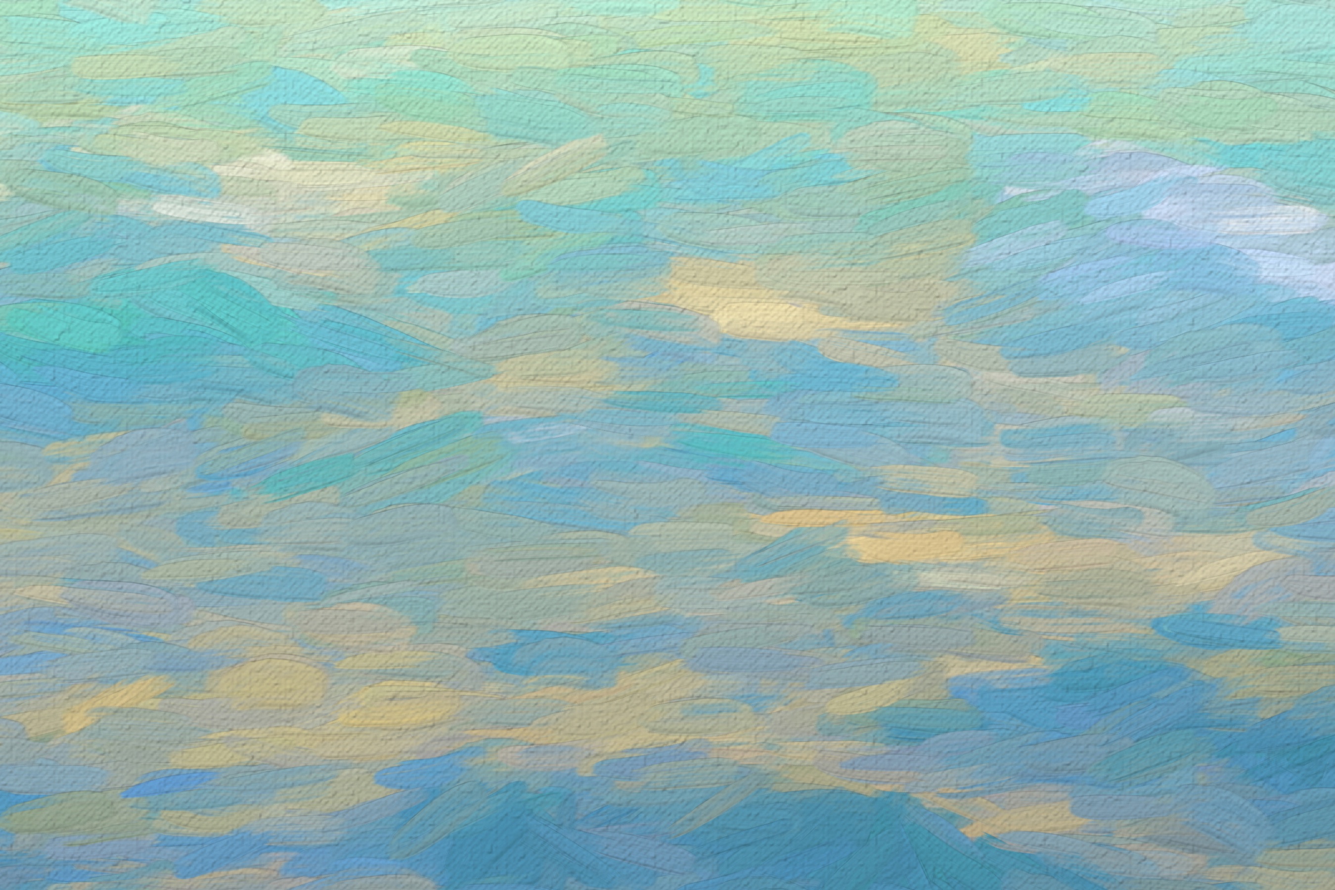
The colour of the river is blue-green (due to the amount of eroded limestone and sediment in the water…compliments of the Niagara River and the American and Horseshoe Falls) and, as is typical with water, it always picks up light from the sky and surrounding land forms…gorgeous and very exciting for artists!
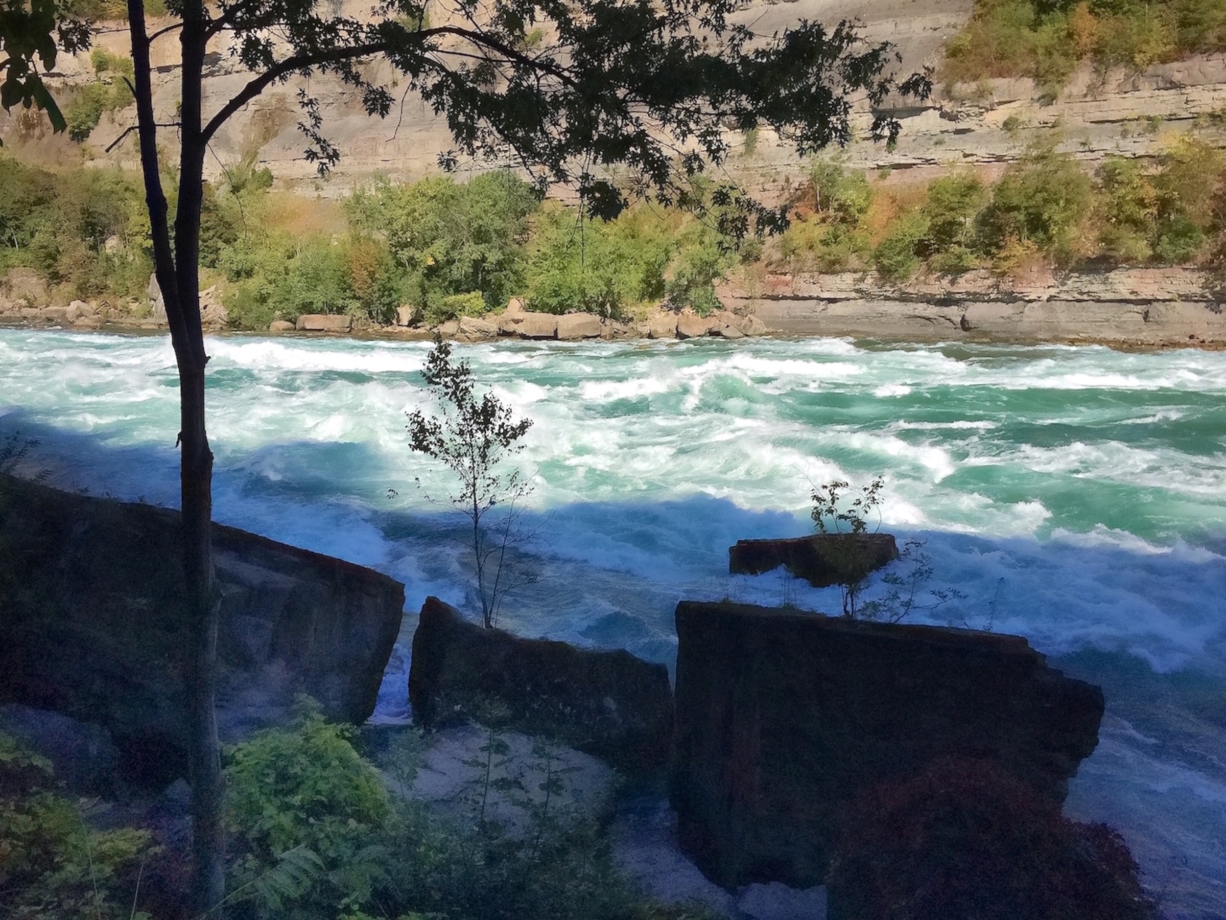
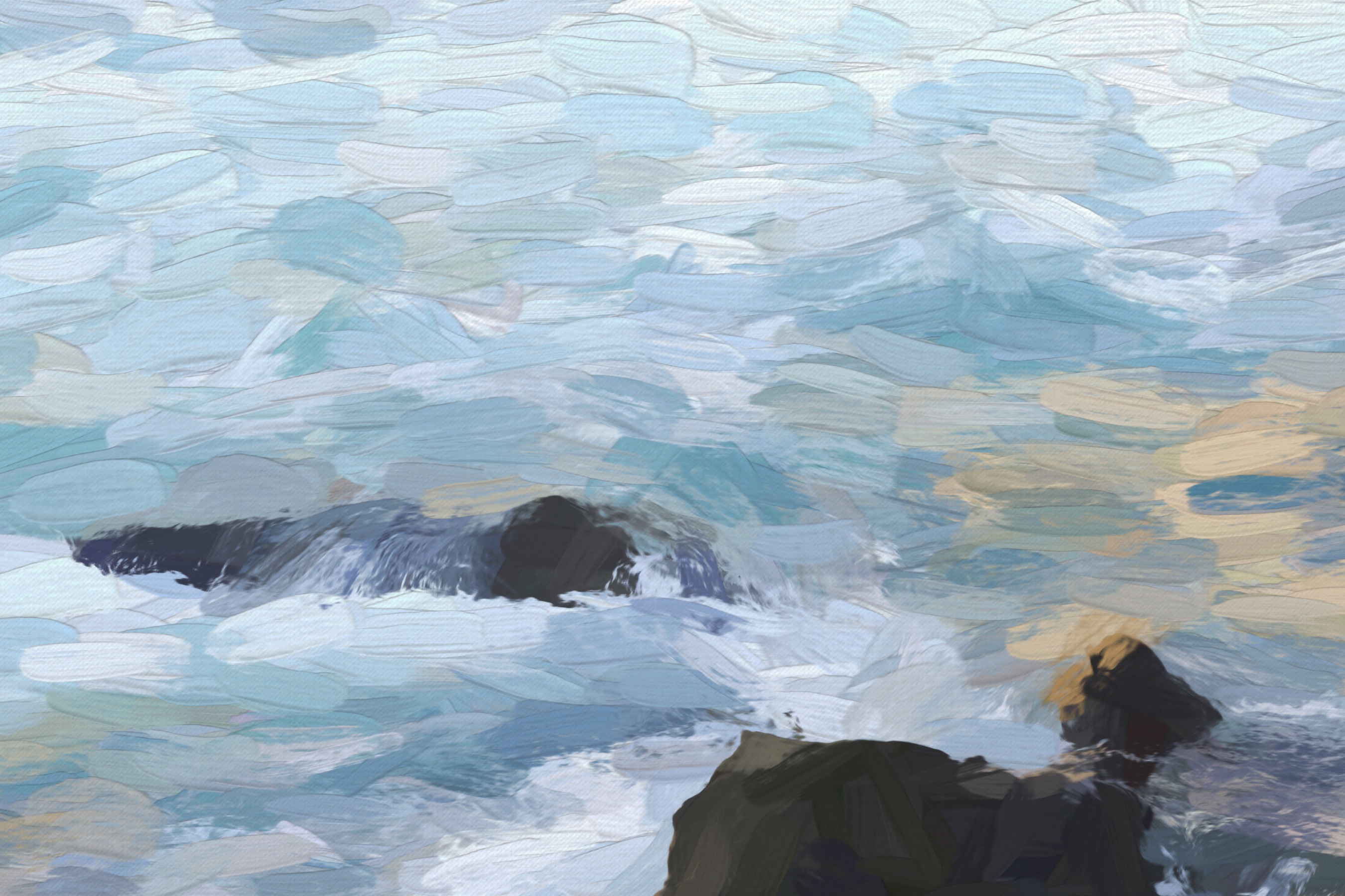
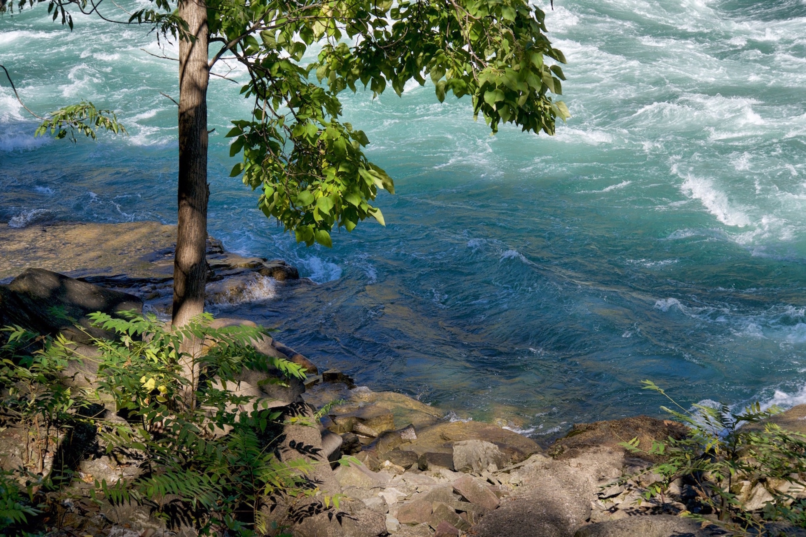 Below is a picture that provides some context to judge the size of the waves. It is of a tree (about 2 meters tall) near the river’s edge with water being pushed up onto the bank by the rushing river. This photograph was taken from a slightly higher vantage point looking down and across the river.
** If you are enjoying this article, subscribe to receive information about my work and creative process, and also get access to my free ebook about becoming more creative.
![]()
The waves in the background are in the 70 meter expanse/width of the river. Given this impression of distance and the number of swells you see, you can sense the degree of turbulence in the water and surmise the size of the waves…they were high, and there were quite a few of them.
You can imagine standing beside the tree and your view of the other river bank being blocked by the many overlapping wave formations flying by…
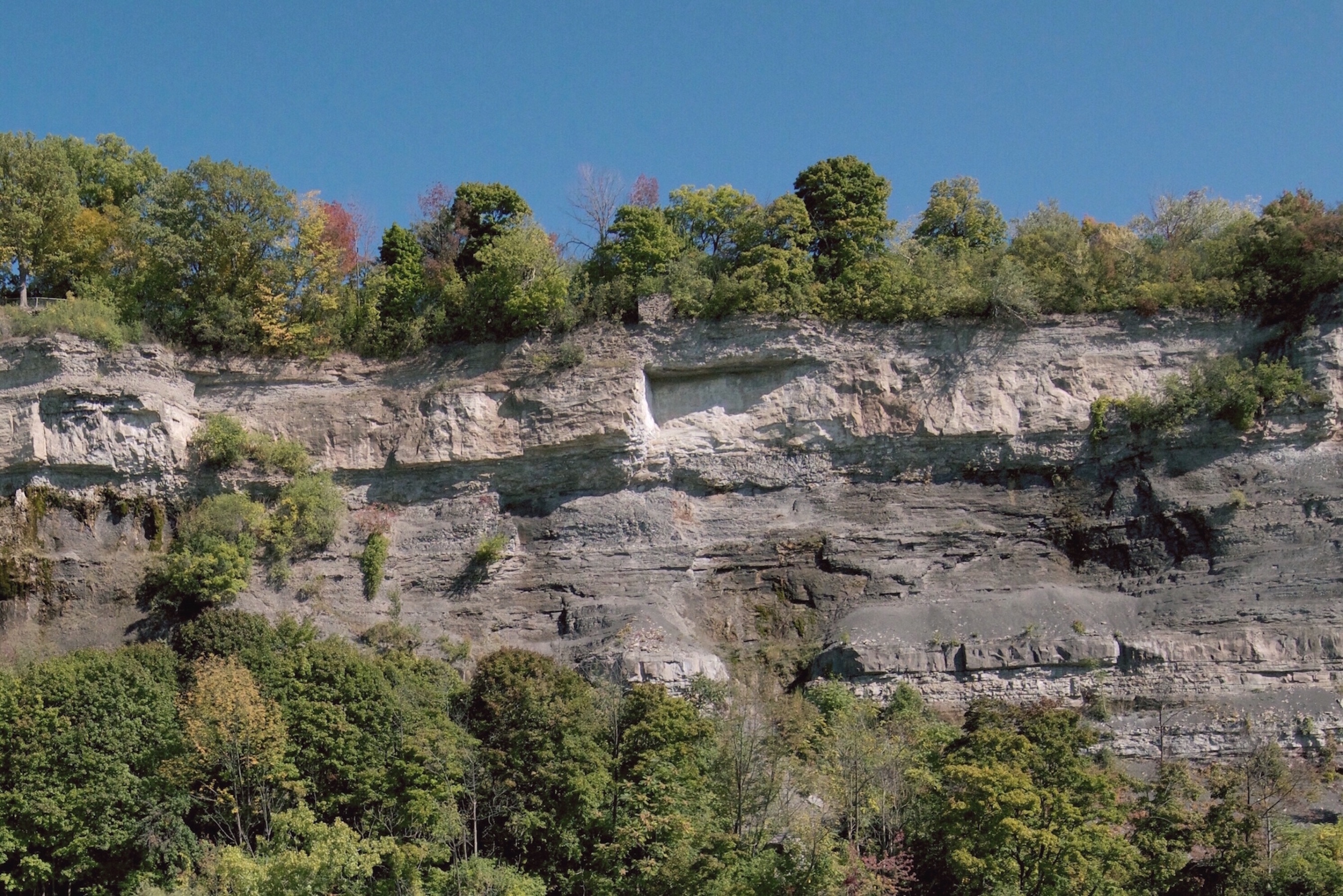
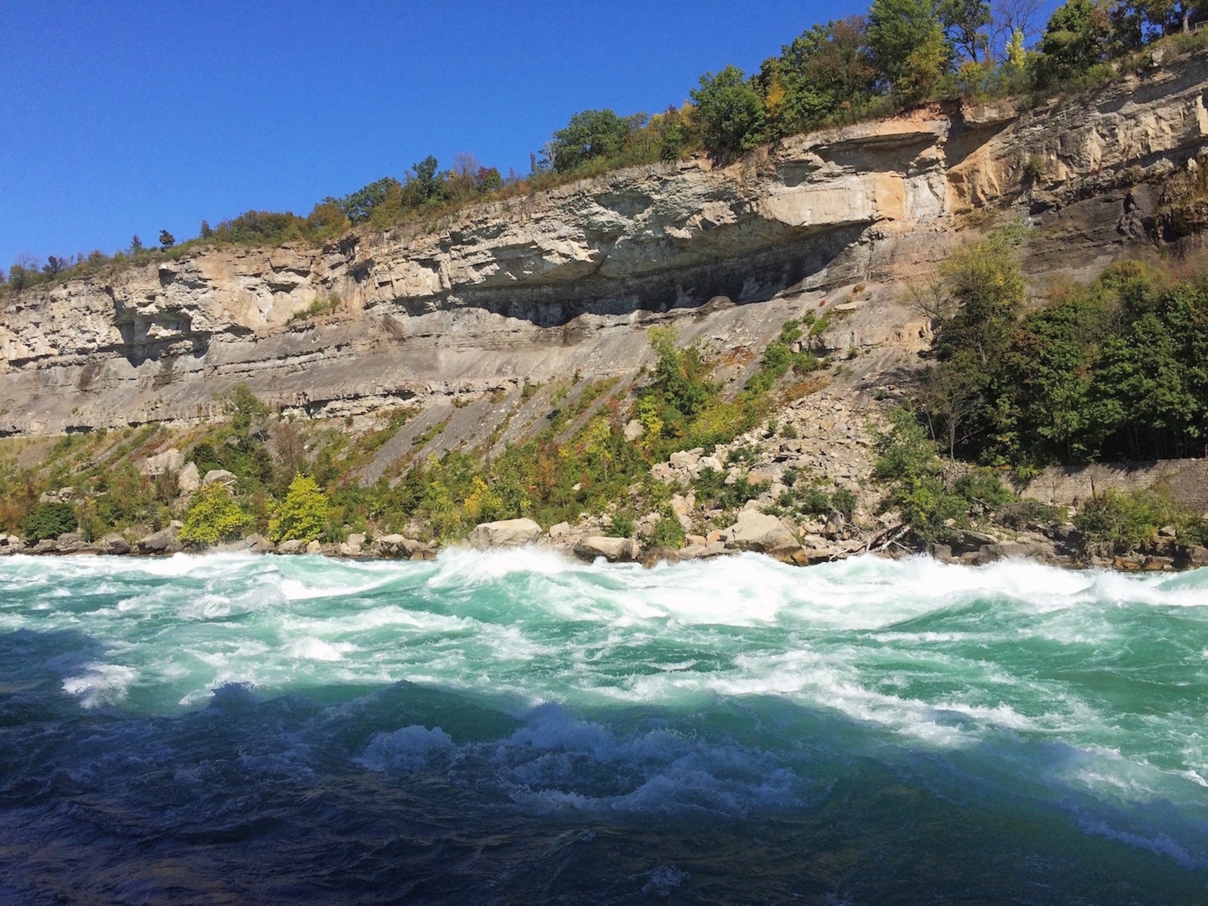
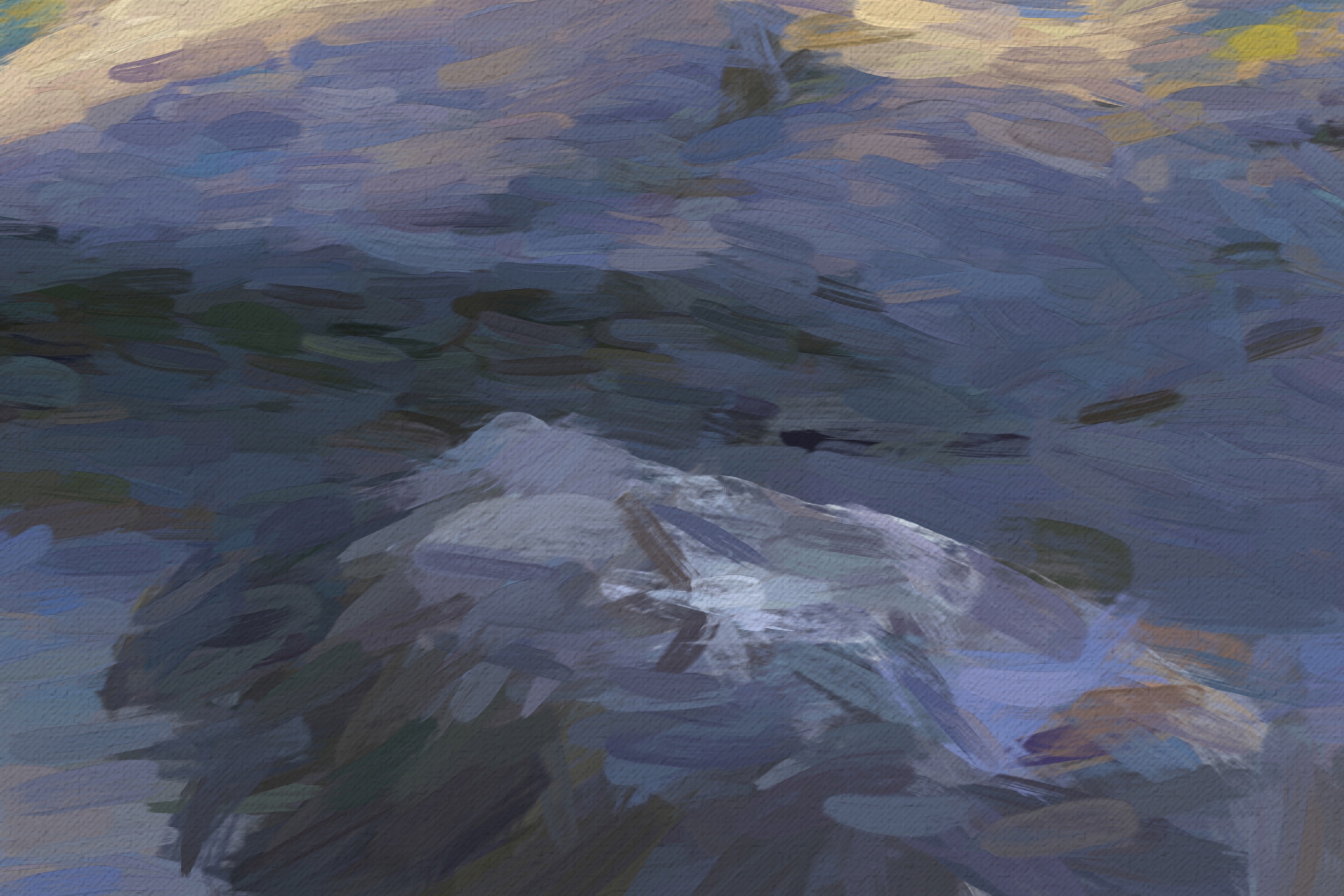
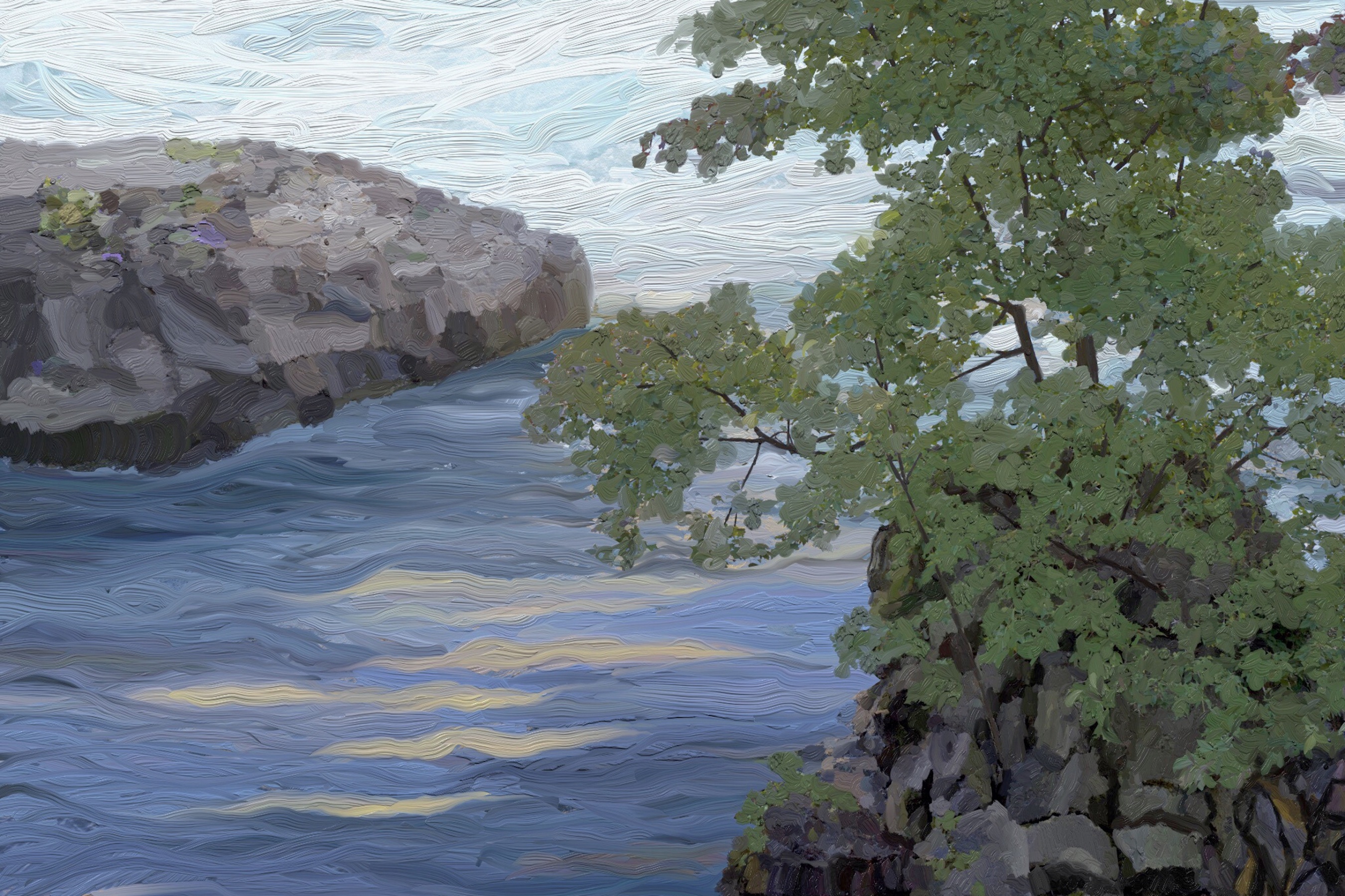
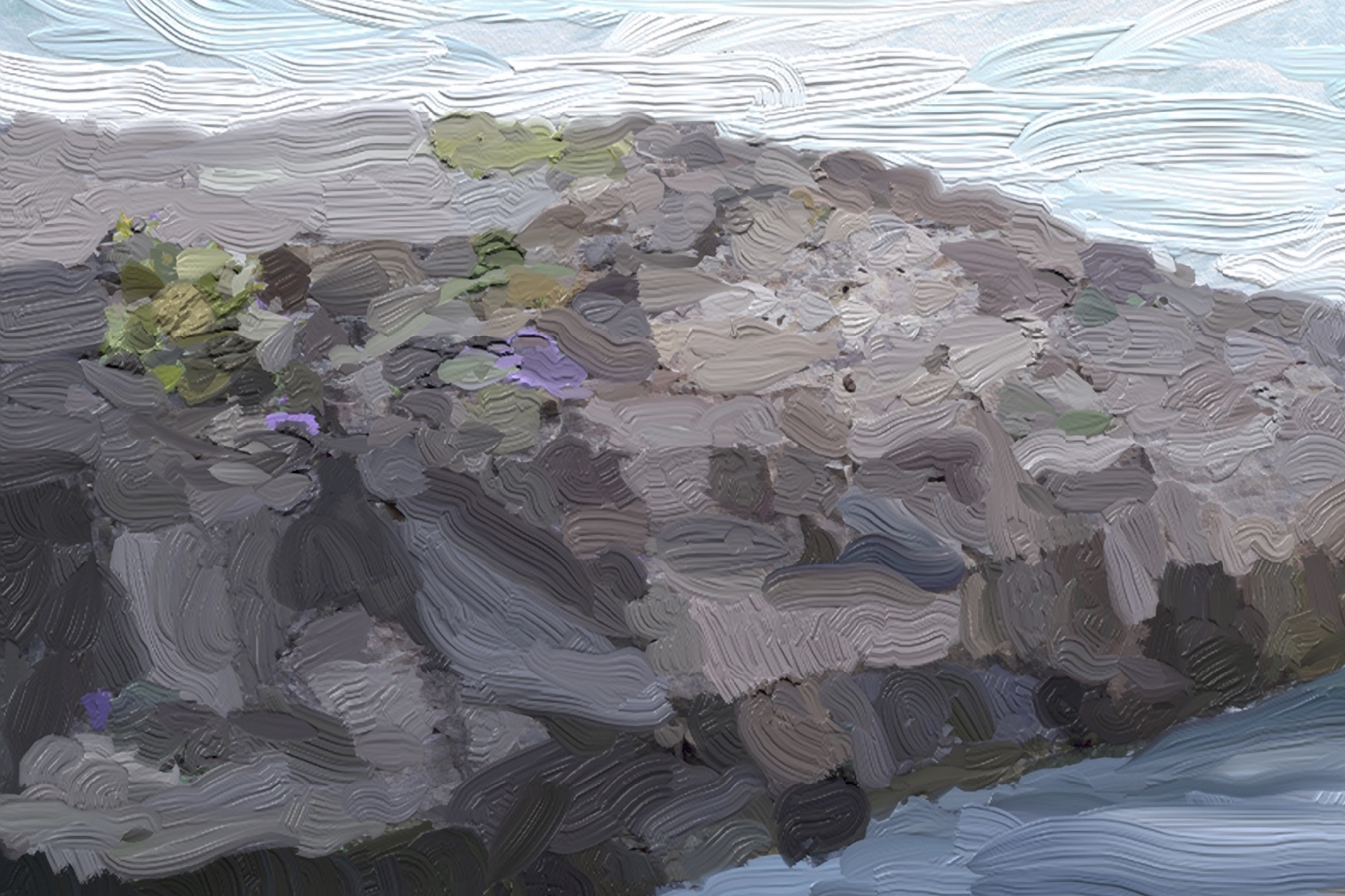
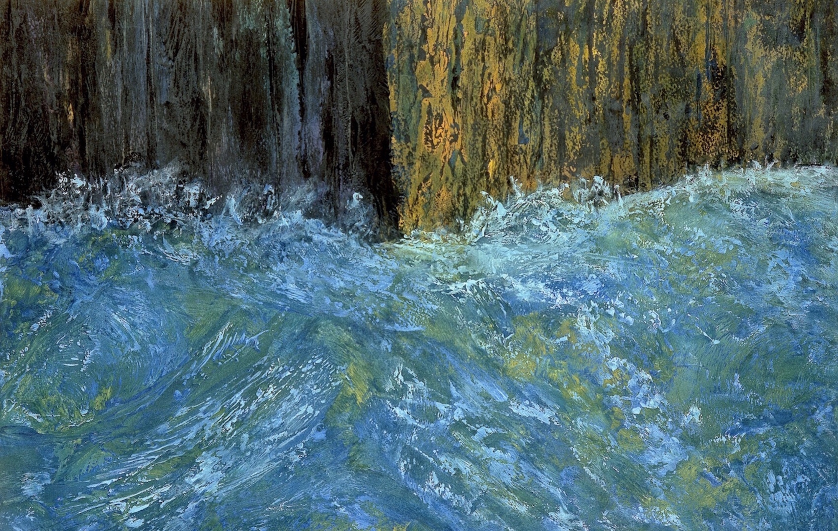
A shot looking down river and across to the opposite bank. Notice the protrusions of hard sedimentary limestone. You can see the eroded cliff-edge (soft shale) extending almost halfway up the rock face and can clearly see where it’s eroded away underneath the limestone. This limestone “shelf” will eventually collapse under its own weight without any support from underneath. This happens every year along the river and poses a danger to people who choose to disregard posted warnings in high-risk areas along the shorelines.
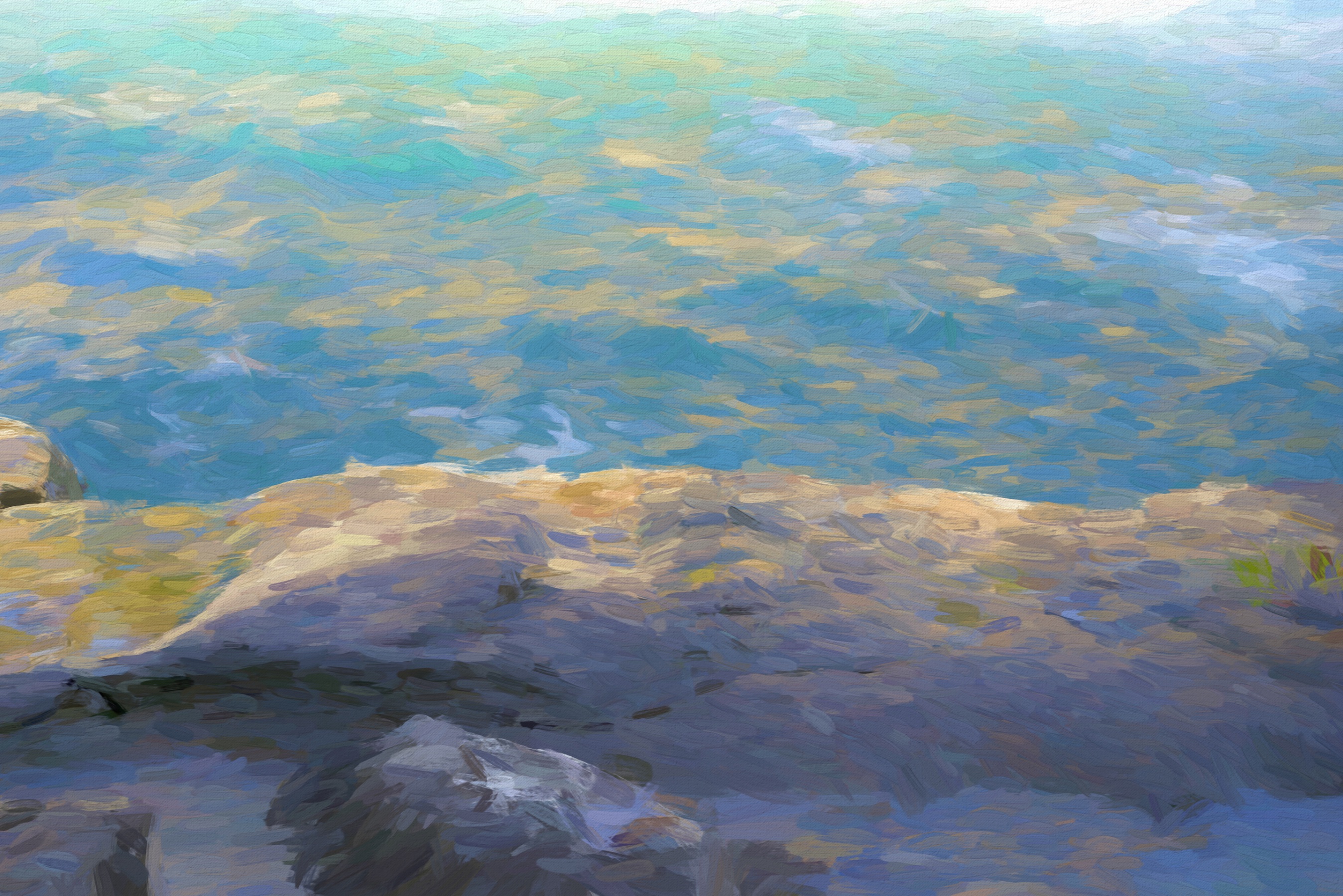
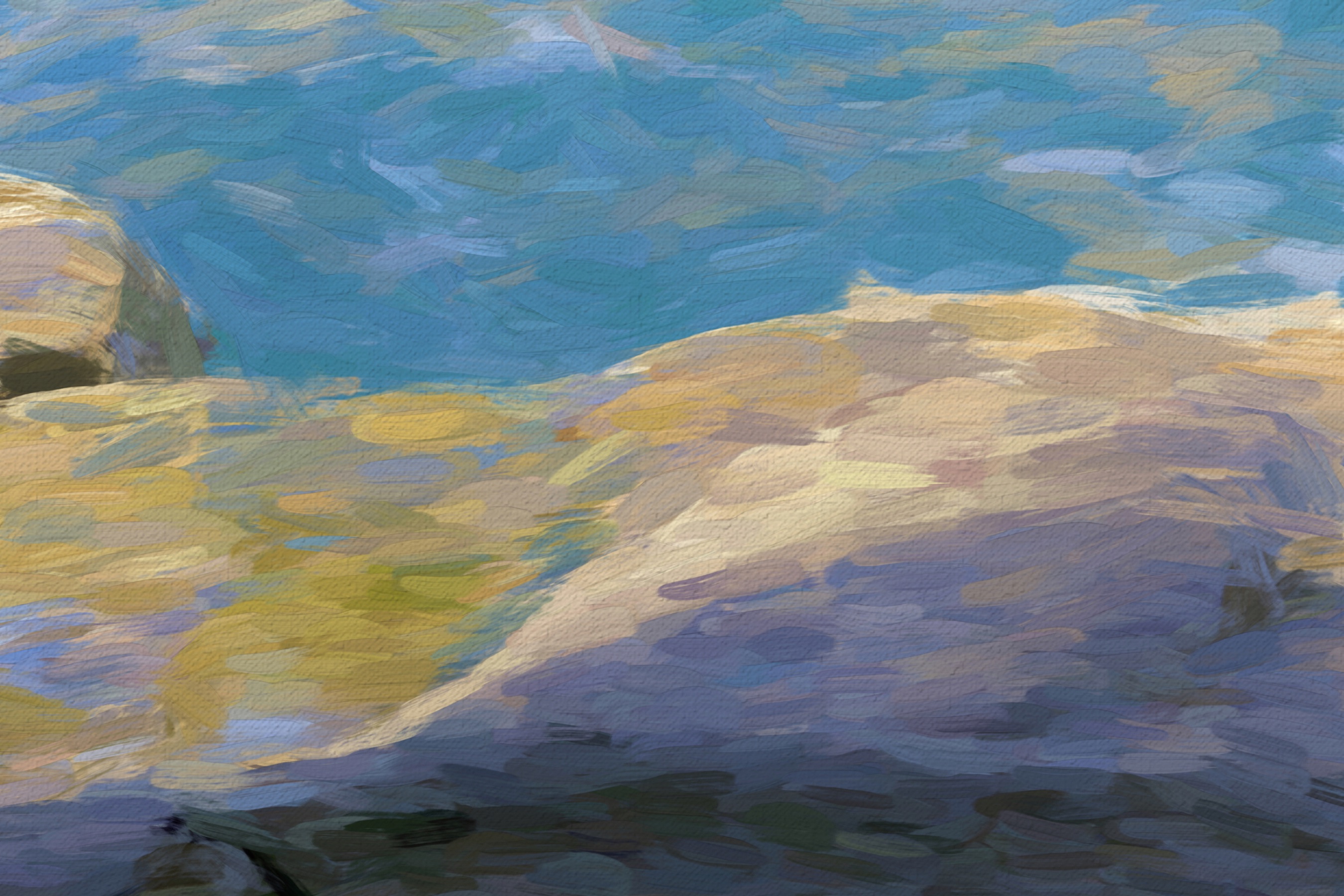
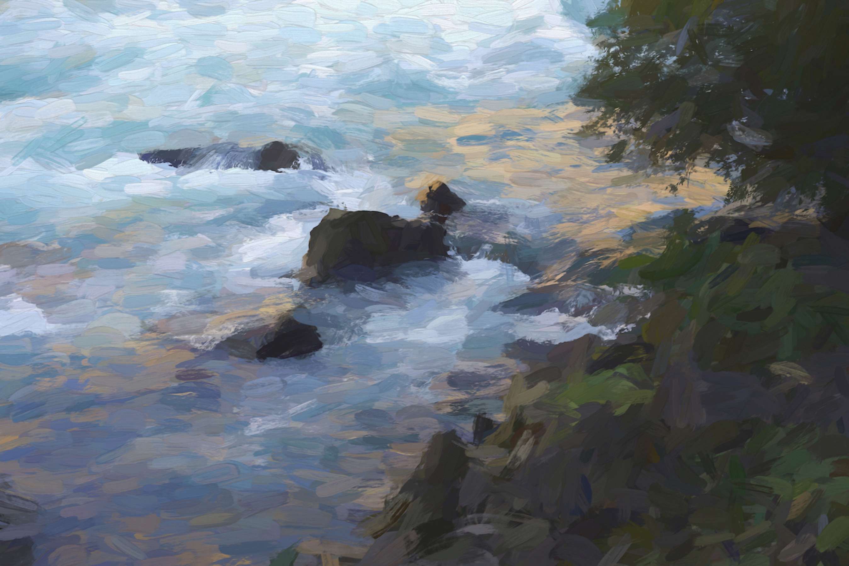
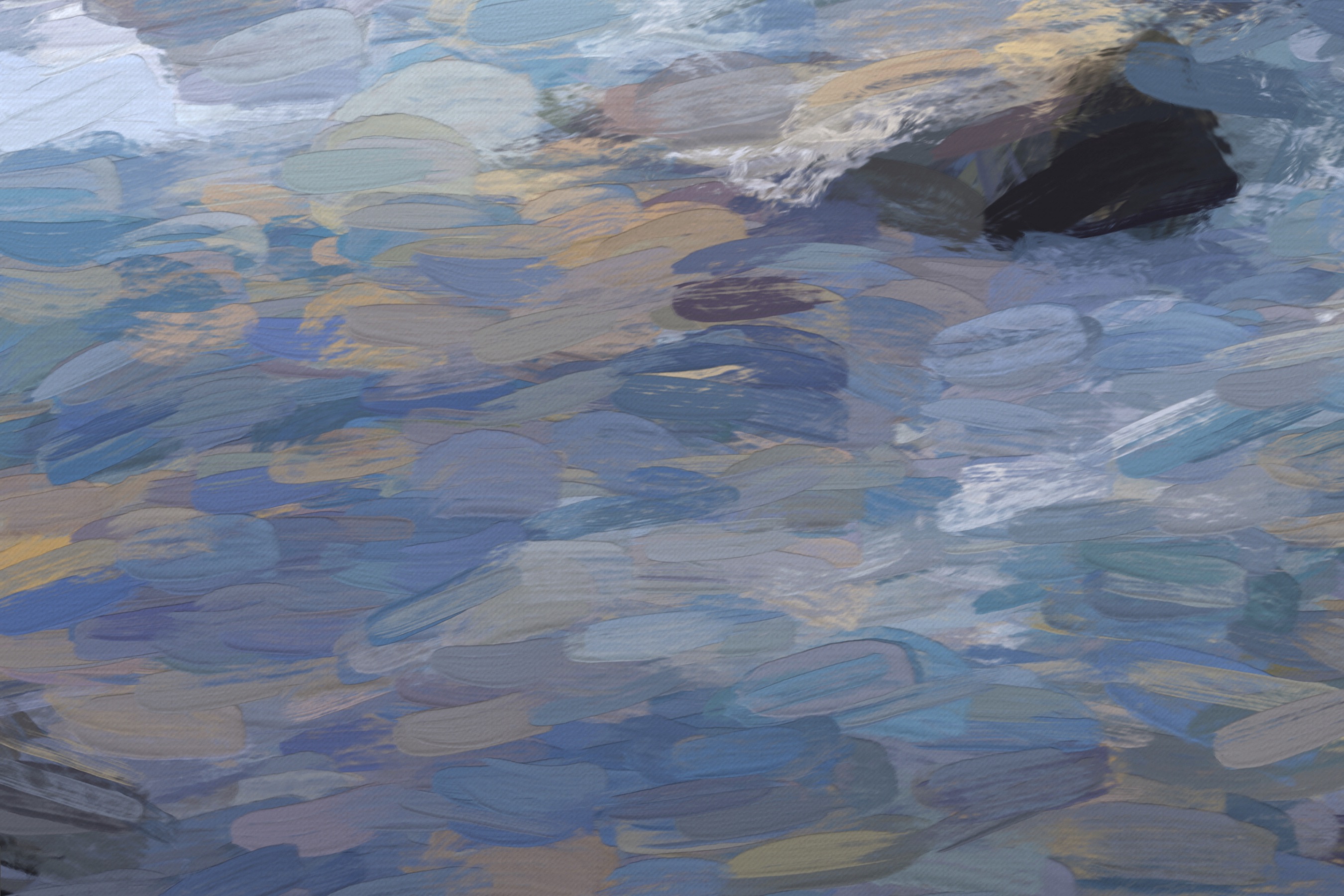
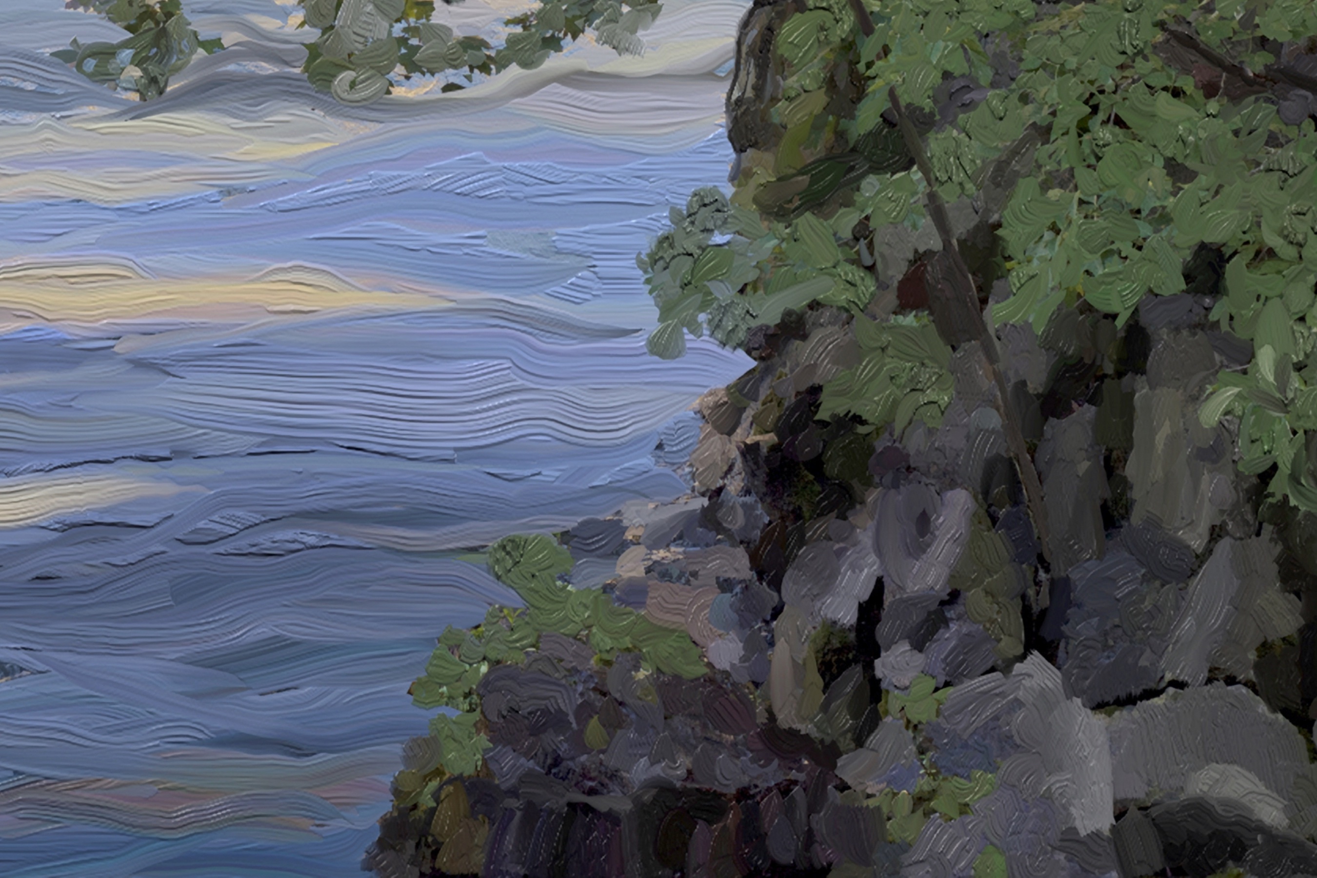
The opposite side of the gorge was in golden sunlight during my last visit to the area. This was reflected by rocks and water on my side of the river. Here’s a photo and a paint sketch (with detail views) reflecting the sunlight gorge wall:
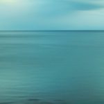
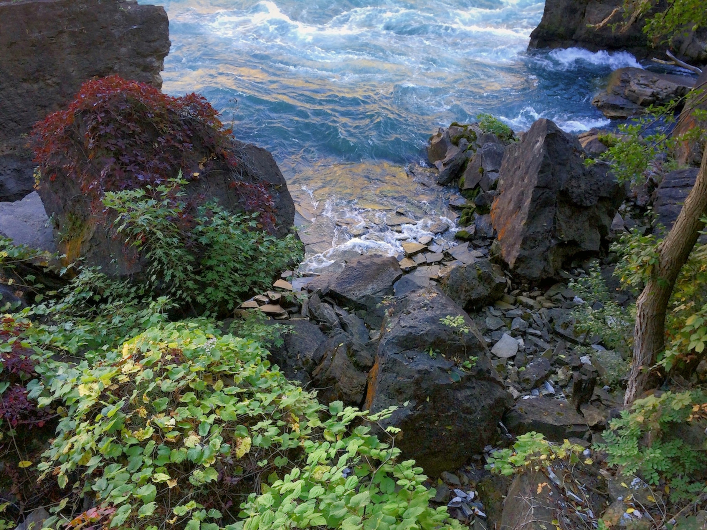
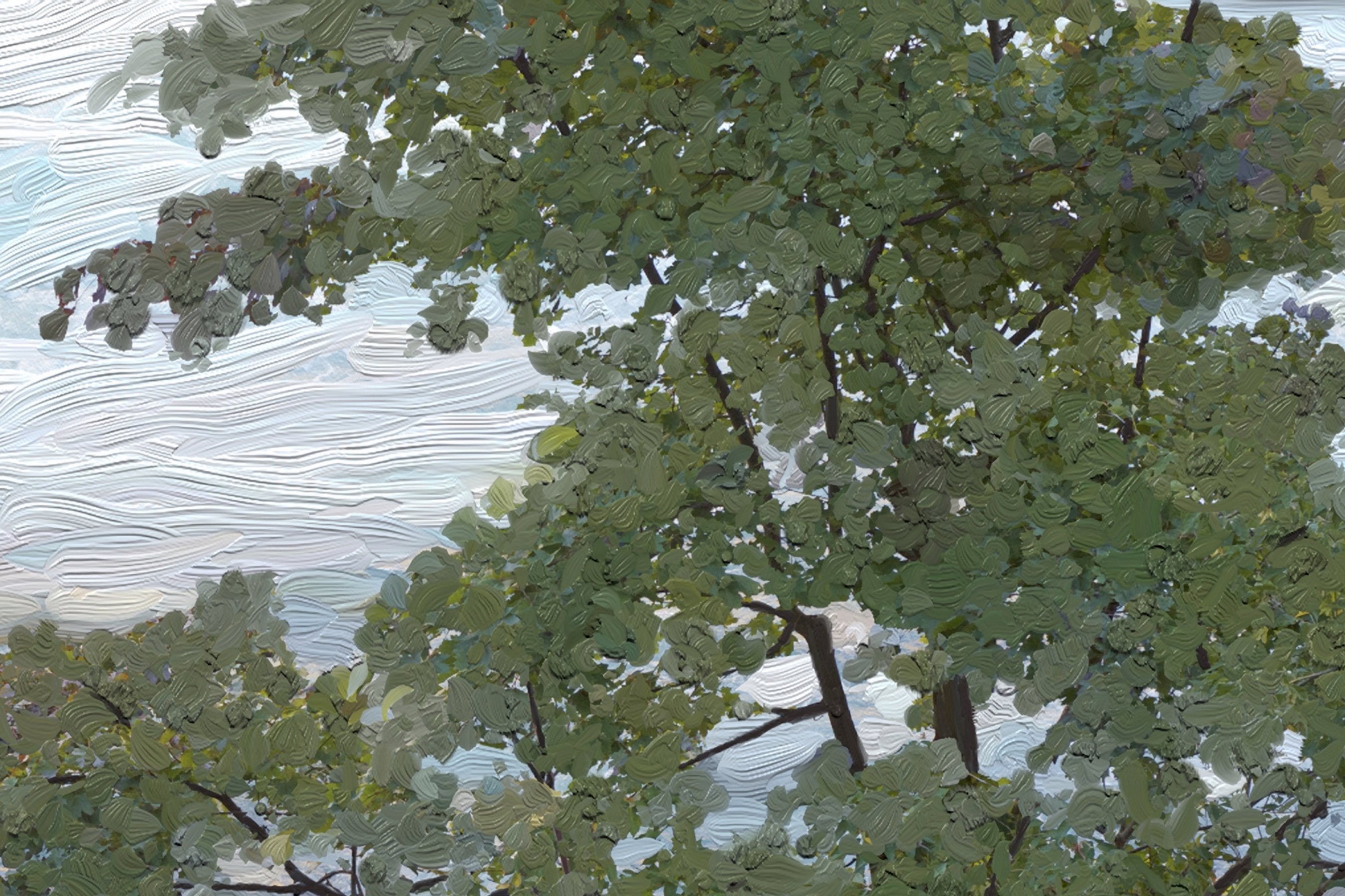
In contrast to the dramatic whitewater, there are portions of the shoreline that are quite serene despite the nearby raging water.
Here are some photos and paint sketches (with close-ups):
Some close-ups of this paint sketch:
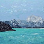
A second paint sketch from the trip followed by close-ups:
And finally, here is an older painting (that I’ve held onto) that was partially inspired by the Niagara River:
Recursive Terminus, Oil and Wax, 2008, 14 x 21 inches
I hope you’ve found this interesting and that it may even prompt you to visit the Niagara region if you’re nearby or may be travelling to the area in the future.
Please let me know if you have any questions about the area or about any of the photos or paintings presented here.
Michael C
If you found this article interesting, subscribe to receive information about my work and creative process, and also get access to my free ebook about becoming more creative.
![]()